Houston's weather is about to change fast. After Monday, the region is expected to turn into a much wetter pattern that could last at least a week, and possibly longer.
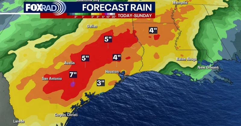
Widespread showers are expected to start later on Tuesday and continue through Tuesday night, with rain likely to hang on through the coming weekend. Most of the area is expected to pick up between 3 and 5 inches of rainfall, and some locations could see more than 5 inches.
A weak front is expected to approach Houston and may push into the area Tuesday evening or overnight, and that could be the trigger for stronger thunderstorms with damaging winds and possibly hail. The timing is still uncertain, but the setup raises the chance that the front could affect the commute home Tuesday evening or arrive later in the night.

By Wednesday and Thursday, daily rain chances for nearly the entire area are expected to be about 80 percent. Highs should stay in the low- to mid-80s, with overnight lows in the mid-70s, keeping the air warm and sticky while the rain keeps coming.
The broader reason is simple: the atmosphere over Houston is expected to turn unsettled this week without high pressure to steady it, while a stalled frontal boundary and very high moisture feed the rainfall. A Stage 1 flood alert is being held off for now, but it is being watched closely as the wet pattern is expected to persist through the weekend and possibly into early next week.
For Houston, the immediate question is no longer whether the rain is coming. It is how much falls where, and whether the front arrives early enough on Tuesday to turn a wet commute into a rough one.