
KTIV said the largest severe storm threat would build into Sunday evening, and it made Sunday a First Alert Weather Day as a Tornado Watch covered most of Siouxland until 10 p.m. Severe storms were expected from 4 p.m. to 11 p.m., with a few tornadoes possible, including some strong ones.
The same system could also bring large hail up to three inches, isolated damaging winds up to 85 mph and flash flooding that could not be ruled out. The Storm Prediction Center placed all of Siouxland under a level 3 out of 5 Enhanced Risk, underscoring how broad the threat could be as the region moved into the evening.
Sunday afternoon offered one ingredient storms often need. There was quite a bit of clearing, and that could help fuel development before the atmosphere turned active later in the day. High temperatures were expected to reach the upper 70s to low 80s, with wind gusts potentially exceeding 40 mph before the worst of the weather arrived.
The timing is what gives the forecast its weight. Heavy rain was expected Sunday, and the storms were likely to become severe early Sunday night as a cold front slowly moved through Siouxland Sunday night into Monday morning. Light rain was expected to continue into Monday morning, with lows in the 50s as the system lingered.
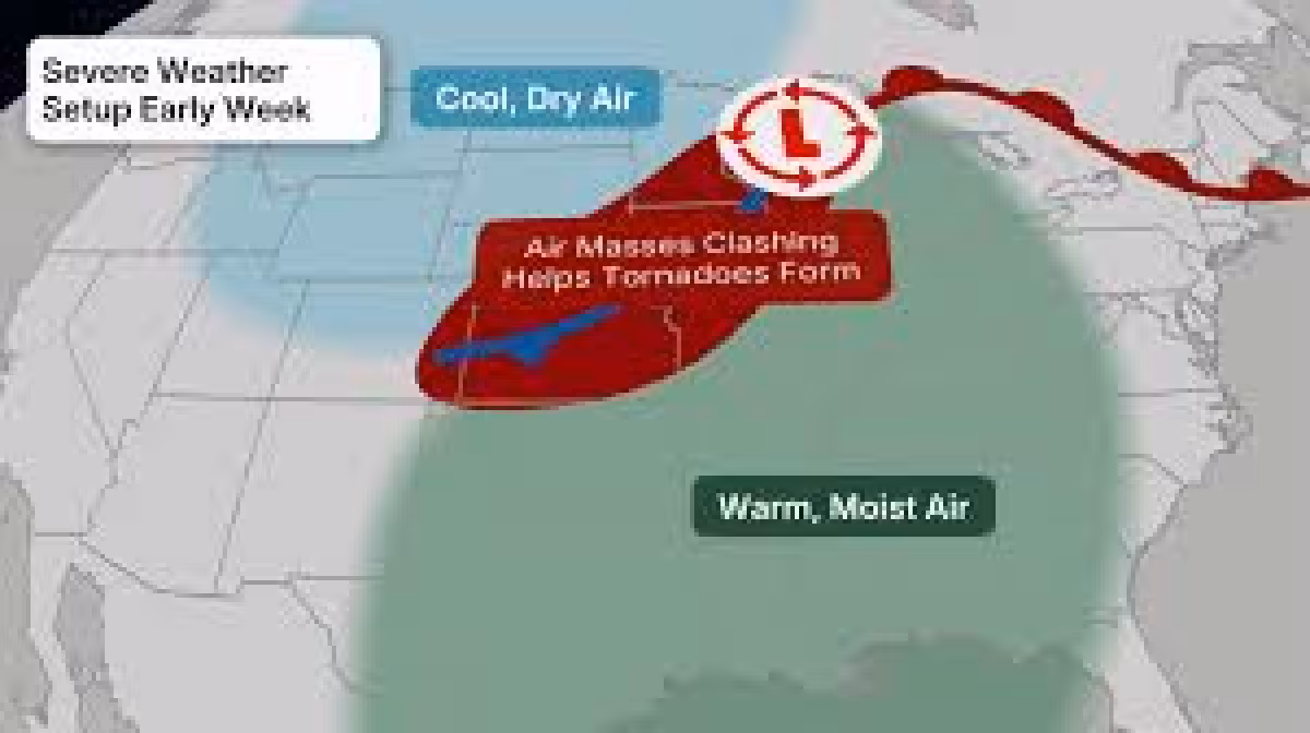
KTIV also marked Monday as a First Alert Weather Day, and the concern does not end when Sunday night does. Severe storms could develop again Monday afternoon, especially along that slow-moving cold front, and the Storm Prediction Center issued another level 3 out of 5 Enhanced Risk for southeastern Siouxland.
On Monday, large hail and damaging winds were listed as the main threats, but a tornado threat was also present. Heavy rainfall could again aid flash flooding, while daytime highs were expected in the 60s and 70s. For a region already bracing for one round of severe weather, the second day keeps the threat window open far longer than a typical evening storm chance.
The rest of the week offers a gradual cooldown and then a slow recovery. Tuesday was expected to start with a lot of clouds before clearing into the afternoon, with wind gusts that could exceed 30 mph and highs in the low 60s. Wednesday should bring a slight warmup with partly cloudy skies and highs in the mid 60s, and Thursday was expected to near 70 degrees under partly cloudy skies.
The immediate question for Siouxland is no longer whether the weekend system will matter. It will. The practical issue is whether the first round Sunday evening or the second round Monday afternoon becomes the more disruptive one, and both are close enough together that residents will need to stay alert through the entire 24-hour stretch.