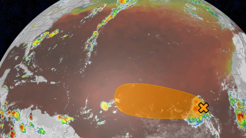
Tropical Storm Dolly formed Thursday morning in the eastern Atlantic Ocean, and the National Hurricane Center says the system is already headed toward a short life. It was the fourth storm of the 2026 Atlantic hurricane season, but it is expected to weaken into a tropical wave by this weekend.
The storm was about 1,500 miles east of the Lesser Antilles and moving west-northwest, far from any immediate landfall concern. That distance matters because forecasters are already watching the same system that could still send locally heavy rain toward the Leeward Islands, Puerto Rico, the Virgin Islands and Hispaniola starting late Saturday and lasting through Monday.
The name is also drawing attention for a reason that has nothing to do with Dolly Parton. The National Hurricane Center said the timing is purely coincidental. The name Dolly was chosen in the early 1990s and has been on a rotating list since 1996, long before this storm formed and long after the naming system was set.

The forecast remains uneasy even as the storm weakens. Dolly is expected to run into dry air and wind shear as it gets closer to the Leeward Islands, with both hostile factors strengthened by El Niño. In simple terms, dry air can erode the storm’s core, while wind shear can tilt and disrupt its structure. That is why the National Hurricane Center expects Dolly to spin down to a tropical wave by this weekend.
But a weakening system does not mean a harmless one. Tropical waves can still carry gusty winds and heavy rain, and the Weather Channel has said those downpours could trigger flash flooding in some areas, especially where the ground rises quickly into hills or mountains. For people in the Leeward Islands, the main window is Saturday night or Sunday, when the system is expected to arrive.
What happens after that is the part forecasters are watching most closely. Once Dolly becomes a tropical wave, it is expected to keep moving west-northwest next week, and a few computer models suggest it could redevelop later next week somewhere near the Bahamas or the Bermuda Triangle. That is not the forecast, but it is enough to keep the system on the board as the 2026 Atlantic hurricane season gets another named storm that may not last long, yet could still leave a wet footprint behind.