


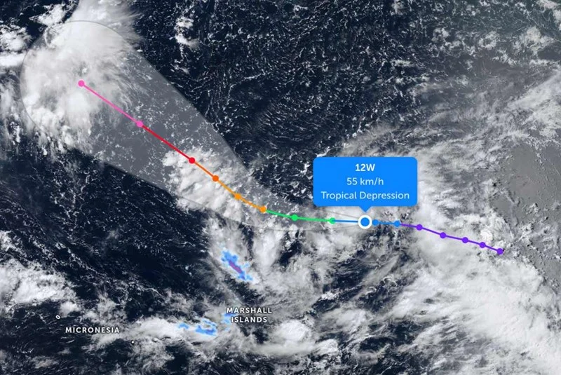
Tropical Depression 12W is forecast to jump from 30-knot winds to super typhoon strength by the end of the week, with JTWC calling for the system to reach about 130 knots by July 31 at 31/0000Z. The storm is consolidating roughly 540 nautical miles northeast of Majuro and is already sending out significant wave heights of 4 to 4.5 meters.
That forecast is drawing attention because the change is not gradual. Over the next 24 hours, TD 12W is expected to organize into a more symmetrical system, then continue westward for 36 hours before turning more northwest over the following five days. For readers trying to size up what that means, the short answer is that the storm is still far from land, but its path and strength are both evolving fast enough to make the next few days critical.

The setup is nearly textbook for rapid intensification. Warm sea surface temperatures of 29-30°C, or 84-86°F, are feeding the system massive thermal energy, vertical wind shear is only 5-10 knots, and the storm has excellent outflow aloft. Those conditions help a cyclone ventilate and deepen, and they are why forecasters expect TD 12W to strengthen quickly rather than slowly.
Even so, the forecast is not locked in at the top end. JTWC is projecting super typhoon strength with max winds near 130 knots by the end of the week, but some aggressive weather models are pushing the peak as high as 150 knots by day five. That gap matters because the timing of the peak and the speed of the strengthening are still uncertain, even though confidence in the track itself is high.
The wind field is also still uneven, with the strongest winds confined mainly to the northern semicircle. Hurricane-force winds are forecast to extend only 50 nautical miles from the center, while 50-knot winds reach out to 80 nautical miles, a reminder that the storm is still organizing even as it accelerates. If the forecast verifies, TD 12W will not just strengthen; it will do so quickly enough to enter super typhoon territory before the week is out.
