


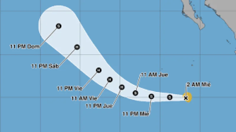
Tropical Cyclone Elida formed in the Pacific on Wednesday and was not threatening land, even as forecasters said it would keep strengthening. By Wednesday, the storm’s center was about 909 kilometers, or 565 miles, south-southwest of the southern tip of Baja California in México.
The storm had maximum sustained winds of about 64 kilometers per hour, or 40 mph, and no coastal watches or warnings were in effect. That distance mattered because it kept the system over open water, away from the immediate changes in pressure and friction that can slow a storm’s organization once it nears shore.
That open-water setup helps explain why the forecast called for more strengthening. The Centro Nacional de Huracanes said Elida was expected to become a hurricane by Thursday night and reach its peak intensity on Friday, a quick climb for a storm that had only just formed on Wednesday 15, 2026.
The contrast is the one forecasters always watch closest: a storm can be far from land and still grow more dangerous over water. Elida posed no direct threat to coastal communities, but its structure was already organized enough for the forecast to point to hurricane strength within a day and a half.
For now, the key question is not whether Elida will affect land, but how fast it will intensify before Friday. If the forecast holds, the storm will spend its next stage out at sea, strengthening away from Baja California before reaching its strongest point later in the week.
