


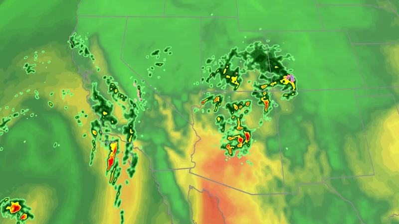
Tropical moisture is setting up a multiday flood and severe weather threat across seven states from California to Colorado, and the sharpest flooding risk moves into Southern California and nearby areas Wednesday overnight. Heavy rain, debris flows and landslides are all in play as storms deepen across the Southwest.
The timing is what makes this forecast matter now. Millions are under a flood watch, and the Weather Prediction Center says rain could fall at rates as high as 2 inches per hour, enough to turn a short burst of training storms into flash flooding. The greatest concern is not just for roads and washes, but for burn scar areas where mudslides can develop fast, along with slot canyons and arroyos that can funnel water with little warning.
Severe storms are expected too, especially across Arizona, where large hail, strong wind gusts and a couple tornadoes are possible along the Mogollon Rim. Strong wind gusts and an isolated tornado threat are also possible along the southern and central California Coast, while parts of California and the Four Corners region are already seeing bands of heavy rainfall.

There is a catch in the forecast that matters for anyone watching Bakersfield weather and the broader California threat. The highest flooding risk begins to shift out of California on Thursday, but that does not mean the danger ends. Moisture will keep pumping into the Southwest, and saturated ground will leave much of Arizona, Nevada, New Mexico, Colorado and Utah exposed to more flooding, while Arizona remains under the greatest risk.
Thursday also brings another round of severe weather, with isolated storms capable of producing strong wind, hail and even a tornado across portions of the Desert Southwest and Four Corners region. Up to 3 inches of rain are expected across parts of the Desert Southwest, and some isolated locations could see 5 inches. Parts of the Sierra and Rockies could also see the first significant snow of the season, underscoring how wide the system has spread and how many kinds of weather it is trying to produce at once.
For Southern California, the immediate question is not whether the storm will be disruptive, but which places will take the heaviest hit before the risk slides east. The forecast points to the greatest flood danger overnight, then a broader hold on the region’s wet and unstable weather through Wednesday night before California’s flood threat eases on Thursday.