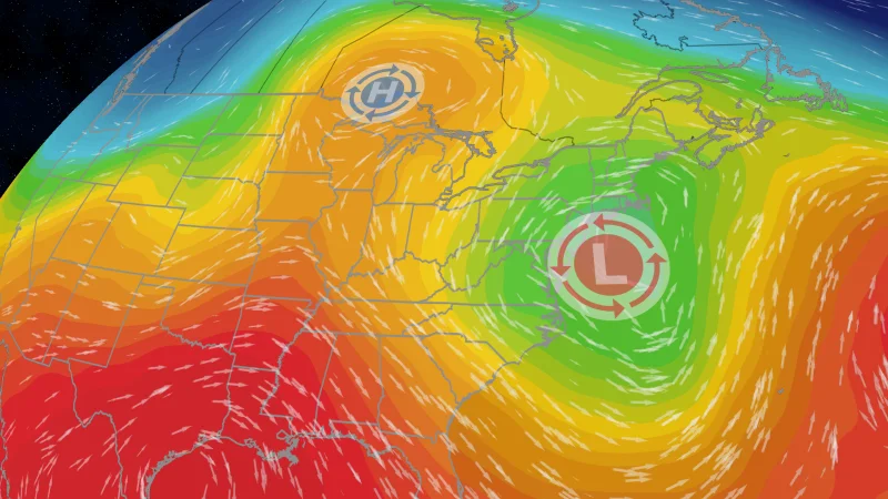
A nor’easter could form off the East Coast late this week and begin pushing wind, rain, high surf and coastal erosion toward the Northeast. The storm could also disrupt travel across the region as the low pressure system gets closer to a high pressure area near the Great Lakes.
That is why the forecast is drawing attention now. Coastal flood alerts are already in place across the mid-Atlantic, and they could bring 1–3 feet of inundation above normal levels. Farther south, the threat is expected to increase by late Wednesday for the lower Chesapeake Bay region, including Norfolk.
The setup is a classic one for a nor’easter: winds blow in from the northeast, low pressure sits just off the coast, and the pressure difference between systems helps strengthen the wind. In this case, the storm is expected to be all rain, not snow, because it is arriving earlier than the late fall and winter storms that usually define the pattern.

The forecast models do not agree on how hard the storm will hit. The European model brings the low close to the coast as a stronger, slower-moving system, which would leave more time for strong winds to drive significant power outages, heavy rain-induced flooding and coastal erosion. The GFS model moves the low slightly faster and has it nearing New England by Saturday afternoon, which would trim some of the worst impacts but could still leave longer-lasting problems in some coastal areas as the storm strengthens again by the end of the weekend.
That split matters because the difference is not small. Several inches of rain could fall across the region, and gusts up to 45 mph could be enough to trigger power outages and travel delays along the coast and even inland. Heavy rain along the shore raises flash flooding concerns, while strong onshore winds would keep coastal flooding in play for the lower Chesapeake Bay and other exposed stretches of the coast.
For now, the most likely outcome is a messy late-week storm with a broad impact zone and a track that will decide how severe the damage becomes. If the slower European model wins out, the Northeast gets a longer period of wind, rain and flooding pressure. If the faster GFS track verifies, some of the worst coastal impacts ease, but not before the region spends the next few days watching the forecast tighten around whether the storm stays near the coast or pulls away sooner.