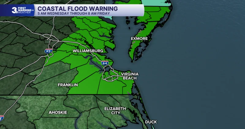
A coastal flood warning goes into effect Wednesday afternoon as northeast winds strengthen and tidal flooding is expected to hit both high tide cycles. The warning comes as the weather turns more coastal and less flash-flood focused, a shift that puts flood-prone areas on alert even though the rain threat eases a bit.
Tony Nargi said the warning begins tomorrow afternoon, with tidal flooding expected around the 8 AM and 8 PM high tides. Winds are expected to turn out of the northeast at 20 to 30 mph by afternoon, with gusts topping 40 mph, and rainfall should total around 1 inch.
That mix matters because the worst flooding risk is not tied to the heaviest rain. Tomorrow is expected to bring lower chances of flash flooding than today, but the stronger wind and steady tide setup can push water into low-lying spots anyway. High temperatures will only reach the low 70s, a sign that the air mass itself will stay unsettled while the coast takes the brunt of it.

By Thursday, the setup turns more serious. There will be less rain, but more wind and tidal flooding, with moderate to major flooding expected in the morning and evening and 2 to 3 feet of inundation possible in flood-prone areas. Winds will stay strong out of the northeast at 20 to 30 mph, with gusts up to 40 mph, which can keep water from draining back out between high tides.
For now, the clearest advice is to stay out of flood-prone coastal areas during high tide cycles and expect changing conditions through the end of the week. Friday should bring similar conditions with occasional showers and pockets of drizzle, strong winds and tidal flooding, and temperatures that may struggle to get out of the 60s. The broader coastal storm is expected to linger to the north on Saturday, then turn west on Sunday, which could bring more showers before calmer conditions return on Monday and Tuesday.
The same forecast also notes Tropical Storm Fay has become a post tropical cyclone and that an area of interest off the coast of Africa has a 30% chance of development, but those systems are separate from the coastal flood warning now driving the local concern.