


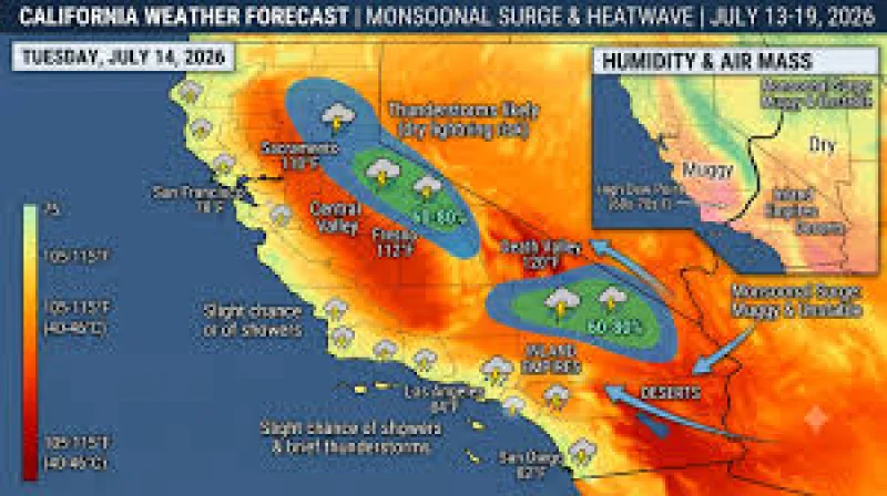
The North American monsoon is underway, and it is already turning the Desert Southwest into a storm zone. Strong to locally severe thunderstorms are firing across Yavapai and Gila counties this afternoon and evening, with flash flooding, outflow winds and blowing dust all in play.
That is why people are searching for what is a monsoon today: it is no longer a distant seasonal concept, but the weather pattern shaping travel, outdoor plans and safety across Arizona and beyond right now. Forecasters say the first widespread summer thunderstorms are set to spread across the interior West this weekend into next week as deeper moisture moves in and the atmosphere becomes more receptive to daily storm growth.
The setup is classic monsoon country. The North American monsoon is a seasonal wind shift that pulls deep moisture north from the Pacific and the Gulf of California, and this burst is being fed by southerly winds drawing increasing moisture into the region as high pressure settles over the Four Corners. Scattered to numerous afternoon and evening thunderstorms are expected across Arizona, New Mexico, southern Utah, southern Colorado and Nevada, while the Weather Prediction Center has expanded a Marginal Risk of excessive rainfall into Tuesday and Wednesday.

That broadening risk matters because the threat is not the same everywhere. The flash flooding concern is concentrated near the Four Corners and can run border to border, with the heaviest rain expected over southeast Utah and southwest Colorado. Farther south, localized flash flooding becomes possible Sunday into Monday across southern Arizona, while the first significant monsoon burst of the season is also expected to elevate the dust storm threat. Interstate 10 between Phoenix and Tucson remains the marquee dust corridor, and Maricopa County is still flagging blowing dust as the leading daytime hazard.
There is a sharp edge to the pattern. Storms over the Seven Cabins and other area burn scars near US 70 in Ruidoso, New Mexico, can send debris-laden water across the road with almost no warning. WeatherNation says strong, dusty outflow winds can sharply reduce visibility along area highways, and frequent lightning threatens hikers and anyone caught outdoors. The same system that can drop much-needed rain on drought-parched land can also trigger haboobs, dry lightning and fast-moving floodwater.
By Monday, active monsoon conditions are expected to lock in as deeper moisture floods the region, and the flash flooding threat is expected to broaden north into the Great Basin and northern Rockies. Phoenix is still running 108 to 110°F underneath the storm threat, a reminder that the heat is not gone just because the sky is changing. Through Wednesday, the better question is not whether storms will form, but where the heaviest downpours, dust and runoff will land first.
