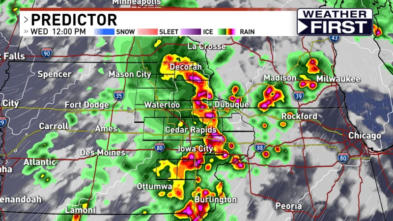
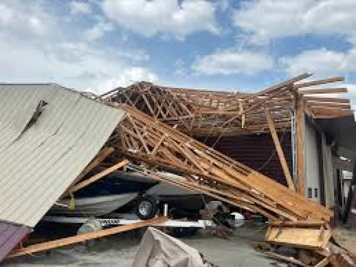
Eastern Iowa is facing a very active two-day stretch, and today starts it. KCRG has issued the first of two First Alert Days in a row as strong to severe storms become likely this afternoon and evening, with damaging winds, large hail and tornadoes all possible.
The reason people are watching the forecast so closely today is simple: the threat is already on the clock. A morning round of storms could develop between 10:00 a.m. and 1:00 p.m., then another round is likely near and after 3:00 to 4:00 p.m. as a frontal boundary moves into the area. Storms should quickly turn severe in the afternoon and evening, with the greatest tornado risk in individual storms and the stronger wind threat more likely in lines of storms.
That makes today a day where timing matters as much as intensity. If the morning storms organize within a few hours of development, they could turn strong to severe before the afternoon. If not, there is still a later window when storms are expected to form ahead of the front and push through eastern Iowa before beginning to move out late in the evening. Quieter conditions are likely for much of the night after that.
The bigger wrinkle is Thursday. It is also a First Alert Day, and the Storm Prediction Center again has most of the area in an enhanced risk, with a slight risk outside it. A cluster or line of storms is expected to form overnight in Nebraska and western Iowa and move east in the morning, bringing damaging winds as the main threat, along with hail and even an isolated tornado. If the atmosphere recovers after that morning round, more severe storm development is likely late morning into the evening, and all of the severe hazards would be back on the table.
Rain will be part of the story too. Between today and Thursday, 1 to 2 inches of new rain is quite possible, with isolated higher totals that could lead to some flash flooding in the worst spots. River flooding is not a major concern right now because levels are generally running low, but the heavier downpours could still cause problems where storms repeat or stall.
The unsettled pattern leaves one question that matters most to people across eastern Iowa: how much of the atmosphere survives each round of storms. The morning activity could take some energy out of the air for later storms on Thursday, but if the atmosphere rebounds, another round of severe weather is still likely. KCRG is urging people to stay weather aware and keep checking updates through Thursday.