Pittsburgh faces a stormy Saturday afternoon, with strong to severe thunderstorms expected after 2 p.m. and the main line moving through the city around 4 to 6 p.m. June 6, 2026, was marked as a KDKA First Alert Weather Day as forecasters warned that the most active stretch would arrive later in the day.
That timing matters because the morning and early afternoon still offered dry time, which could make the sharper turn in weather easy to underestimate. Wind gusts around 20 to 30 mph were expected ahead of the system, with temperatures near 80 before the storms arrived.

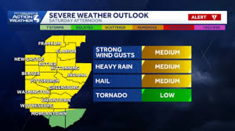
The biggest threats are damaging winds and hail, with an isolated tornado not ruled out. Heavy downpours are also likely as the line moves in, and the severe weather risk was classified as a slight risk, or 2 out of 5 on the Storm Prediction Center Outlook. For anyone planning outdoor events or travel in Pittsburgh, that puts the afternoon and early evening squarely in the path of the day’s most serious weather.
The storms were expected to move south of I-70 after 9 to 10 p.m., leaving patchy fog possible overnight. Sunday should turn quiet and dry with highs in the mid 80s, but the break will be brief: next week is expected to be very humid and hot, with highs in the upper 80s and feels in the 90s for some. Tuesday night and Wednesday morning are the next chances for rain showers, which means the next official weather update will hinge on how this Saturday line builds and whether warnings are issued for specific areas.