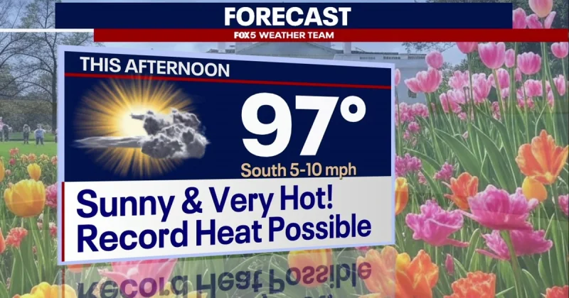
Mostly sunny skies and intense heat were set to grip the Washington, D.C., region on Tuesday, with highs expected to reach about 97 degrees and the day billed as the hottest of the week. Temperatures started the morning in the upper 60s to low 70s, and only a very limited chance of a stray pop-up storm was expected to interrupt a mostly dry day.
That makes Tuesday the peak of the stretch, and it also puts the region back in range for possible record highs. Tonight was expected to stay mild, with lows in the 60s, before one more hot day on Wednesday pushes temperatures into the mid-90s.
By Wednesday afternoon, the pattern starts to turn. Showers and storms were expected to develop later in the day, then become more numerous through the Wednesday evening commute and continue overnight. The severe threat appeared low, but the timing could still complicate the drive home and the overnight hours for anyone on the road or working outside.
Forecasts called for showers to linger into Thursday and continue at times on Friday, keeping the end of the workweek unsettled. The holiday weekend was expected to turn cooler, with clouds and occasional showers hanging around before conditions may dry out by Memorial Day.
The forecast, issued by the FOX 5 Weather Team and the National Weather Service, comes with the kind of heat safety advice that matters on days like this: take breaks at job sites, check indoor spaces that can heat up quickly, never leave anyone in a vehicle, and scale back outdoor activity during the hottest hours. For Washington, that means Tuesday is the last and hottest test of the stretch, and the cooldown begins after one more round of summerlike weather on Wednesday.