


Temperatures are about to fall fast. A strong cold front is expected to move through on Thursday, Nov. 12, and by Friday the air will feel more like late winter than early November, with readings tumbling from the 70s into the 50s and snow possible in the highest mountain elevations.
For readers checking the forecast now, that shift is the reason the word freeze is suddenly on the radar. WBTV’s First Alert Weather team has issued first alerts for three upcoming mornings, signaling several stretches near or below freezing as the coldest air of the season pushes in across Charlotte and Western North Carolina.
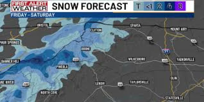
The sharp turn comes after a run of warm November weather, and it marks the region’s first taste of winter this season. Gusty winds will make the change feel even more dramatic, especially in the mountains, where snow showers are possible Thursday into early Saturday along the North Carolina and Tennessee border.

Some of the highest peaks could pick up 1-3 inches of snow, while most mountain communities will see much less. That gap matters because it keeps the snow threat focused on the tallest elevations even as the colder air spreads much farther south and east.
The forecast also carries a contradiction that will matter over the weekend: the air stays cold, but the sky turns nicer. Afternoon highs are expected to remain in the 50s this weekend, below normal for this time of year, even as conditions turn dry and bright and a few mountain peaks could still hold onto snow.
By the time Friday arrives, the change will be obvious without needing a weather map. The next thing readers should watch is how many of those first alert mornings actually land at or below freezing, because that will determine how hard the cold snap hits before the weekend settles in.