


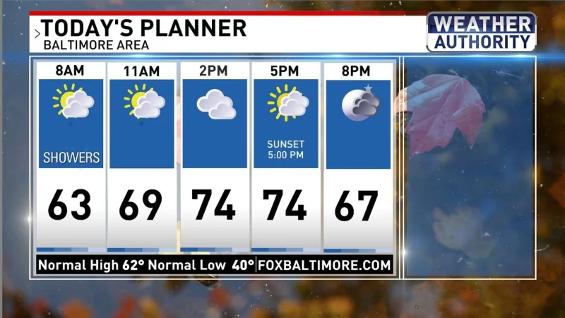
Scattered showers moved through Baltimore overnight into early this morning, ending the region’s dry stretch and setting up a second round of rain for later tonight. Most of the area picked up its first measurable rainfall since mid-October, but the break from wet weather is not expected to last long east of I-95.
Drier conditions were winning out this afternoon, yet the setup still favors another wave of rain east of the front this evening and into the night. Locations west of DC and I-95 were likely done with this event, while people in areas along and east of that corridor were likely to see more scattered rain start to redevelop around 6-8 PM.

The difference across the region comes down to where the front stalls. As it gets hung up along the coast, moisture can keep riding back in over eastern areas even while the west dries out. Pockets of steadier rain were possible after midnight, and some rain was expected to continue through tomorrow morning. Parts of southern MD could see close to an inch or more, while the rest of the area was expected to get barely a quarter of an inch.
That leaves Baltimore in a narrow middle ground: enough rain to matter, but not the heavier totals expected farther south and east. The bigger issue is timing, with the wettest stretch likely arriving after the afternoon dry-out has already given the impression the system is moving on. By tomorrow, highs are expected to be around 70 degrees, but that brief mild spell will give way to a colder, drier pattern. Highs are expected to struggle to hit 60 degrees on Saturday and Sunday, with overnight lows back in the 30s and 40s.
After that, the pattern settles down. A series of fronts is expected to pass by Monday through Wednesday, highs should reach the upper 60s by Tuesday, and then fall to the mid-50s by next Thursday. No rain is showing up in the extended forecast, which means the late-night showers may be the last meaningful wet weather for a while.