

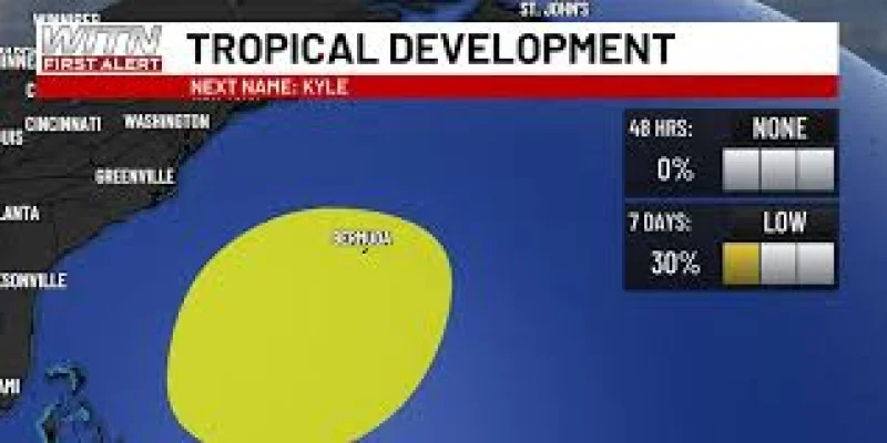
The National Hurricane Center is watching an area of low pressure that could take shape in a couple of days along a weakening frontal boundary a few hundred miles northeast of the Bahamas. If it organizes, the system may briefly pick up some subtropical characteristics late this week as it drifts over the western Atlantic.
That is why the setup is getting attention now. The disturbance is still just a monitored area, not a confirmed tropical or subtropical cyclone, but the window for development is short and falls squarely in the next few days. For anyone following Wptv coverage of Atlantic weather, the timing matters because the system is expected to evolve while it is still over open water, not after it has already passed a settled forecast point.

Subtropical systems sit between tropical and non-tropical storms. They can draw energy from both warm ocean water and the kind of boundary that is helping this one form. In practical terms, that means forecasters are looking for a broader circulation and enough organization to separate it from the surrounding weather pattern. The National Hurricane Center has not gone farther than that, but its language leaves open the possibility that the low could become a subtropical system before conditions start to work against it.
Those conditions are the catch. The same system that may briefly organize late this week is expected to move eastward or northeastward into unfavorable environmental conditions by the weekend, and the chances of subtropical development should end then. That limits the life span of the setup and also limits the chance that it becomes a longer-lived threat. The forecast discussion does not identify specific land impacts, and it keeps the focus on the western Atlantic rather than on any named stretch of coast.
So the answer is narrow but important: the National Hurricane Center is tracking a low that could momentarily become subtropical late this week, but the odds close quickly as the system moves into a less favorable environment by the weekend.