


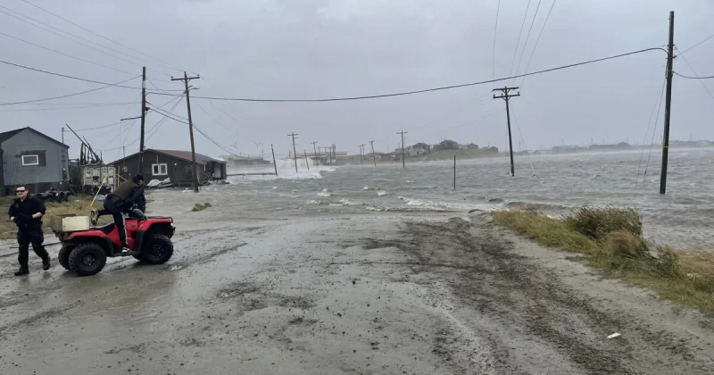
A major Bering Sea storm has pushed onto Alaska’s coast, bringing rain, snow and damaging wind to western and northern communities and setting up the highest impacts through Friday. By 7 a.m., gusts had already topped 50 mph in Bethel, Hooper Bay and Gambell, with more than one weather problem arriving at once.
That is why Alaska Winter Storm Warning Snow is drawing attention today: the storm is already onshore, and the worst of it is timed for the next day rather than later in the week. Water levels are expected to rise from the Southwest Coastline to Utqiagvik, with the highest levels on Friday, while heavy rain spreads across much of the Western Region and heavy snow builds inland on the Seward Peninsula.

The snow totals are especially sharp in the places where cold air can grab the storm’s moisture and wring it out. Nome and Southern Seward Peninsula locations are likely to see 3 to 7 inches of snow through Friday into Saturday, but the heaviest snow is expected in the Noatak alley and Brooks Range, where 10 to 20 inches could fall from Friday through Sunday. Along the Aleutian Chain, the same system is forecast to bring heavy rain and wind gusts of 70 to 75 mph through Friday, with lingering gusts continuing into Saturday as the storm slowly weakens.
Not every part of Alaska is getting the same hit. Southcentral is expected to stay relatively quiet, with temperatures in the 30s Friday and the 40s into the weekend, cloudy skies building late Friday and overnight Saturday, and no significant impacts from the storm at the time of the report. Southeast is also improving, with skies turning sunny from Yakutat to Ketchikan through Friday and more sunshine expected Saturday, even as parts of the storm continue to move through the state.
The uneven footprint matters because it shows how one system can slam the coast while leaving other regions with little more than passing clouds. North Slope impacts are expected to arrive Friday evening and continue through the weekend, and Fairbanks is likely to see only light, scattered snow on Sunday, while impacts in the Interior remain low. The storm will not be done in one wave, but its sharpest punch is coming now, and the next clear shift will be toward weaker winds and weaker showers on Saturday.