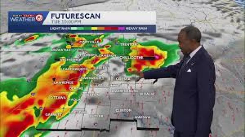
The damaging wind threat from Tuesday night storms was no longer a concern, and the forecast attention in Kansas City shifted to flooding Tuesday night through Wednesday morning. Rounds of rain were expected to keep going into Wednesday and Thursday, with some of the rain heavy at times.
A Flood Watch was in effect south of Kansas City, where the wettest weather was most likely to settle. Radar estimates showed 1 to 4 inches had already fallen Tuesday evening in some areas, and another 1 to 3 inches was expected across the area as the rain continued.

The heaviest rain stayed mainly south of I-70, a boundary that mattered because the strongest rainfall axis was not spread evenly across the region. That left spots of flooding possible during the wet stretch, especially where repeated rounds of rain passed over ground that had already taken on several inches.
The risk was not about severe wind anymore. It was about duration, with Wednesday bringing more rain and cooler weather and Thursday set up for yet more heavy rain. A major fall cool-down was also expected to sweep in, but the first problem had to be cleared first: how much more water falls overnight and where the heaviest band sets up south of Kansas City.