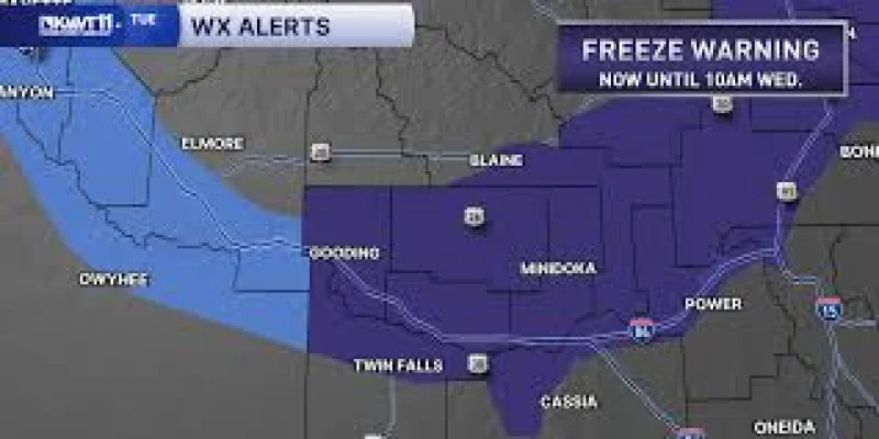
A freeze watch is in effect until 10 am Wednesday as cold air continues to settle in and overnight lows stay near to below freezing. Avaionia Smith gave the update on October 13, 2026, saying the chill would hang on through the night before temperatures begin to climb later in the week.
That matters now because Tuesday’s highs are only in the low 50s, leaving little room for any meaningful daytime warmup before another cold night. People in the warned area are the ones who need to pay attention, especially as the warning stretches through the overnight hours when temperatures are most likely to dip below freezing.

Smith opened her update with a simple greeting and then pointed to the same problem in plain terms: cold air is still settling in with a freeze watch in place until 10 am Wednesday. The timing is what makes the alert stand out. Sunny skies are expected to return across most of the area, but the clearing will not erase the cold already locked in near the ground.
By the weekend, high temperatures are expected to reach the low 70s, and overnight lows should rise into the upper 30s and low 40s. That is a steady rebound, not a sudden flip, which means the next day or two still carry the risk of near-freezing mornings before the warmer pattern fully takes hold. For readers tracking the colder stretch, the key question is not whether relief is coming, but which areas are still under the warning when the clock reaches 10 am Wednesday.
The broader picture is a short cold snap giving way to gradual warming, the same pattern reflected in a Denver Weather: Colorado storm brings hail, snow and freeze watch update linked alongside the forecast. For now, the freeze watch remains the immediate concern, and the first real break from it should arrive after Wednesday morning.