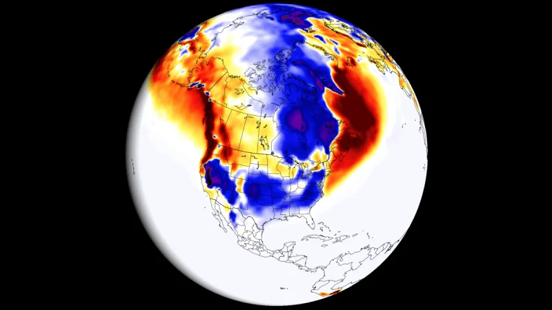
First Winter 2026/2027 snowfall predictions are now pointing to a strong Super El Niño impact, and the signal is already showing up in the snow pattern. The early forecast picture is not uniform. It points to clear snowfall contrasts across the United States, Canada, and Europe as the season takes shape.
That matters because winter searches are driven by one question: where does the snow line up, and where does it fade? In this case, the answer is tied to a developing Super El Niño in 2026 that is already being used to frame the upcoming winter. The event is expected to peak as one of the strongest such events in decades, and sustained seasonal values have already moved past the +2 degrees threshold that marks a Super event.
The setup behind that signal is unusually strong. NOAA-CRW data shows major warm anomalies across the tropical Pacific, with peak values above 6°C in the eastern regions. A significant temperature anomaly is also sitting in the top 250 m of the tropical Pacific, where peak subsurface departures are over 10°C above normal. The mechanism is simple enough to follow even when the numbers are not: strong westerly wind bursts pushed warm upper-ocean water eastward, building a downwelling Kelvin Wave over the past 3 months and lifting it toward the surface as the event expanded.

That is where the friction in the forecast sits. The event has already crossed the Super El Niño line, but it is still developing and has more growth still to come. In other words, the winter pattern is being guided by an event that is already strong enough to count, yet not finished gathering strength. The latest long-range forecasts are therefore only the first look at how the snow pattern could develop through the upcoming Winter season, not the final word.
The broader climate setup helps explain why the snowfall map can tilt so sharply. El Niño tends to raise precipitation and lower pressure in the central and eastern Pacific while promoting more stable weather and higher pressure in the western Pacific. That ocean-atmosphere feedback reshapes the jet stream and the tracks of low-pressure systems, which is why past strong events are useful for judging where snowfall tends to increase or decrease. The same logic is what makes the early Winter 2026/2027 snowfall predictions worth watching now.
The unresolved piece is the one readers will keep checking: how the monthly snow pattern unfolds across the United States, Canada, and Europe as the Super El Niño matures. The ECMWF outlook is referenced later in the forecast, but the image itself is not included in the text here. What is clear is the direction of travel. The season is starting with a strong Super El Niño signal, and that is already enough to redraw the first expectations for winter snow.