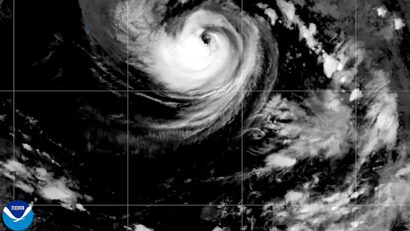
Hurricane Karina formed Sunday in the Pacific Ocean and quickly drew attention for what forecasters expected next: a steady push toward major hurricane strength within about a day or so. The system was already a Category 1 hurricane, with maximum sustained winds of 80 mph, as it moved west-northwest over open water.
That development is why people are looking now for hurricane in California, even though Karina was not aimed at California and was expected to stay well away from land. On Sunday, the storm was about 880 miles west-southwest of the southern tip of Mexico's Baja California Peninsula, far enough offshore that its center was not a direct land threat, but close enough to put coastal conditions back in the conversation.
The National Hurricane Center said Karina was expected to keep strengthening over the Pacific Ocean, where it had room to organize without land disrupting it. That helps explain the forecast for a major hurricane: warm ocean water and a long track over open sea can let a storm build more efficiently, and Karina was already moving at 9 mph, a pace that gave it time to intensify as it traveled west-northwest.

Even with the storm far offshore, the reach of its waves was expected to extend toward land. Swells from Karina were likely to bring dangerous surf and rip currents to parts of southwest Mexico and the Baja California Peninsula, a reminder that a hurricane does not have to make landfall to affect shorelines. The farther the storm stayed out in the Pacific, the less likely it was to damage homes or infrastructure, but the water could still turn hazardous for swimmers and boaters along exposed coasts.
The open question is how strong Karina will be when it reaches its peak. Forecasters said it could become a major hurricane in another day or so, and that makes the next forecast update the one to watch: not whether Karina reaches land, but how much power it gathers while remaining offshore.
Elsewhere in the Pacific, Tropical Storm Lowell was also active Sunday, about 985 miles east-southeast of Hilo, Hawaii, with maximum sustained winds of 50 mph. It posed no immediate threat to land, though forecasters said it could become a hurricane by Monday night or Tuesday.