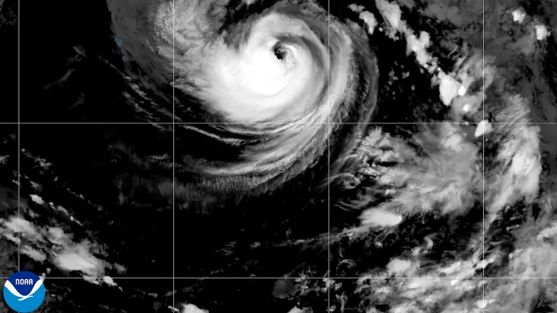
Hurricane Karina was getting stronger over the Pacific Ocean on August 30, reaching 90 mph winds at about 11 a.m. and moving west at near 9 mph. Forecasters said it was expected to become a major hurricane in a day or so, a step that means sustained winds of at least 111 mph.
That is why Karina is drawing attention now: the storm was still far from land, about 950 miles west-southwest of the southern tip of Baja California, but its core was already tight, with hurricane-force winds reaching only 5 miles from the center and tropical storm-force winds extending 70 miles out. That kind of structure can change quickly when a storm remains over open water and keeps feeding on the ocean beneath it.

Forecasters expected Karina to keep moving slowly west to west-northwest over the next few days. That track would carry it farther across the East Pacific, which is part of the reason the storm’s next intensity jump mattered more than any immediate land threat. The question today is not whether Karina has room to strengthen; it does. The question is how far it goes before the next forecast update.
At the same time, Tropical Storm Lowell was far to the southeast, about 985 miles east-southeast of Hilo, with 50 mph winds and a westward motion near 13 mph. It was expected to become a hurricane by Monday night or Tuesday and to reach 110 mph by Friday morning while sitting south of Maui County, but the exact impact on Hawaii remained uncertain. For now, Karina is the storm with the sharper near-term jump, while Lowell is the one whose future track may matter most to Hawaii later in the week.