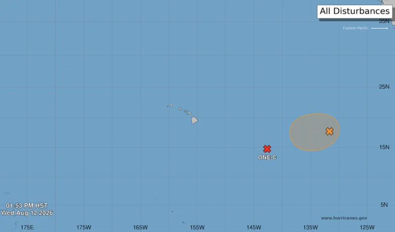
The National Hurricane Center has designated a system a little over 1,000 miles east-southeast of Honolulu as Potential Tropical Cyclone One-C, and it is expected to strengthen as it moves toward Hawaii. Heavy rainfall is expected to begin on the Big Island on Friday, with the worst of the impact spreading across the islands through the weekend.
The timing is what makes this system so immediate. The National Hurricane Center says the storm will likely be named Hernan by Friday at the latest, and by then the rain is expected to be underway, first on the Big Island and then into Maui by the beginning of the weekend. Much of the rest of the Hawaiian Islands could see rain through the weekend, when the system is expected to be close enough to keep the threat going.
The forecast is not just for steady rain. Rainfall totals of 5 to 10 inches are possible across much of the island chain, and some spots could see as much as 20 inches. That kind of water can quickly turn dangerous on steep ground, with life-threatening flooding and mudslides especially likely in mountainous areas. Gusty winds could also knock down trees and power lines, adding another layer of risk for residents and visitors.

What makes the forecast harder to pin down is that the system may still be stronger than a typical tropical storm near the islands. The National Hurricane Center expects Potential Tropical Cyclone One-C to be a strong tropical storm as it moves over or near Hawaii, but landfall as a hurricane is not out of the question. That uncertainty matters because even a small shift in track or intensity could change where the worst rain falls and how hard the islands are hit.
Hawaii has seen this kind of close call before. Hurricane Hone was the most recent tropical cyclone to directly affect the main Hawaiian Islands, passing within about 50 miles south of South Point on the Big Island on August 25, 2024, while strengthening into a Category 1 hurricane. Only two named storms have made landfall on the island of Hawaii at tropical-storm strength, according to the NOAA Historical Hurricanes Tracks database, a reminder of how rare direct strikes are even as heavy rain remains a familiar threat.
The broader pattern in the Eastern Pacific helps explain why this storm is arriving now. Seven named systems have formed so far this season, and the eighth named system typically arrives by August 21. If Hernan becomes a named tropical system by the end of this week, the season will be running about nine days ahead of schedule. Two of the seven named systems have become hurricanes, Fausto and Genevieve, while Fausto also traveled far enough to move into the Central Pacific. For Hawaii, the next question is not whether the rain will come, but where the heaviest bands set up once the system reaches the islands.