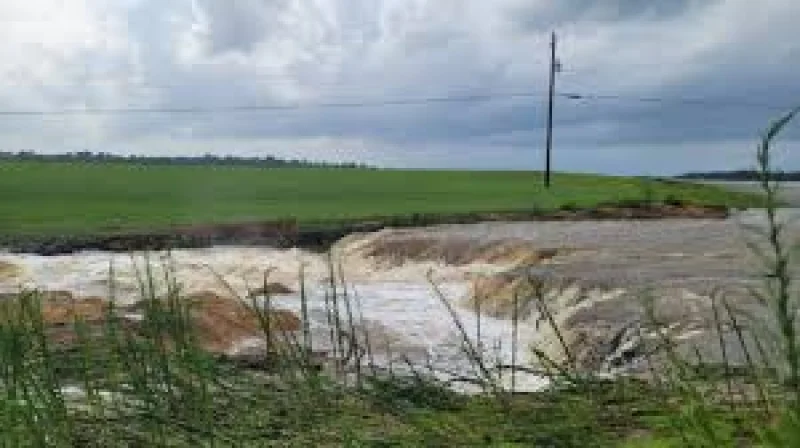
The remnants of former Tropical Storm Arthur pushed tropical moisture across the Gulf Coast and Deep South this week, unleashing widespread flash flooding and leaving roads underwater in communities from Louisiana to Alabama. In parts of Louisiana, rainfall totals topped 20 inches, and emergency crews were still answering water rescues as the worst rain moved on.
The scale was immediate. Plaucheville, Louisiana, recorded 22.71 inches of rain from Wednesday through Thursday, while Simmesport took 17.66 inches. In Mississippi, Perkinston measured 12.38 inches, Whites Crossing picked up 10.51 inches and Kiln reported nearly 10 inches, enough to swamp neighborhoods and push flooding far inland from the coast.

That damage mattered on Friday because the Weather Prediction Center kept a large part of the Southeast under a Level 3 of 4 Moderate Risk for excessive rainfall. More than 2.4 million people were inside the higher-end flood threat zone stretching from portions of Louisiana and Mississippi into Alabama and Georgia, including Baton Rouge, Jackson, Montgomery, Atlanta, Hattiesburg, Slidell, Biloxi and Mobile. The warning was not theoretical; it matched a live emergency unfolding across multiple states.
Jackson County, Mississippi, showed how quickly the storm’s impact spread. Parts of the county saw up to 12 inches of rain, and waterspouts and lightning sparked two residential structure fires. The Jackson County Office of Emergency Services activated its Emergency Operations Center, while torrential rainfall and gusty winds brought down trees, damaged utility lines and forced emergency personnel into multiple water rescues, including one tied to a three-vehicle crash under flood conditions.
The contradiction in the storm’s end was plain: the most intense rainfall had moved out, but flooding concerns remained. That left a broad stretch of the South dealing not with the peak of Arthur’s remnants, but with the slower, more stubborn aftermath of submerged roads, damaged homes and water that was still not gone.