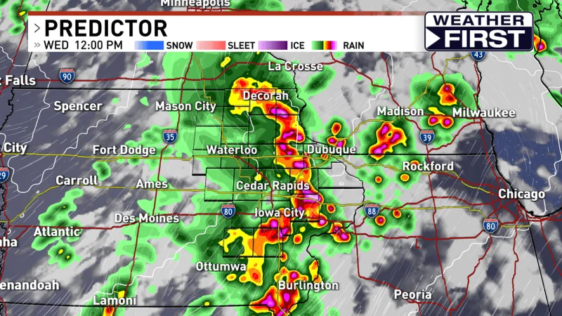
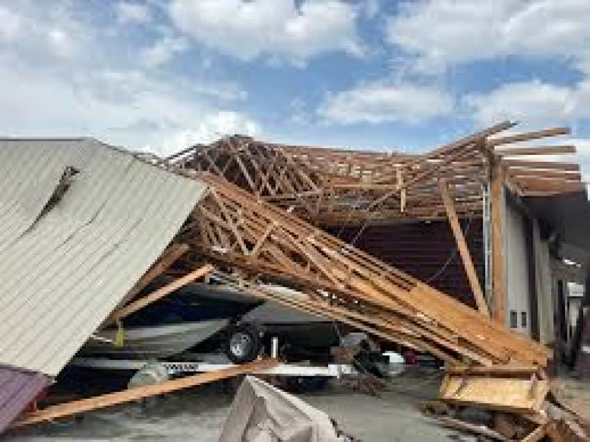
Eastern Iowa is heading into a very active two-day stretch of weather, and Wednesday is the first of two First Alert Days in a row. Strong to severe storms are likely on Wednesday afternoon and evening, with damaging winds, large hail and tornadoes all possible.
The timing matters because the first round of storms could start as early as about 10 a.m. to 1 p.m. Wednesday, then another round is likely later in the afternoon and evening as a frontal boundary moves in. Storms should turn severe fairly quickly, and by late evening the activity is expected to begin pushing out.
The strongest tornado risk would be tied to individual storms, while damaging winds become the bigger concern in lines of storms. That means one storm could spin up a tornado, while a more organized line could spread wind damage across a wider area. Storm development is also expected near and after 3 to 4 p.m. Wednesday, especially ahead of the boundary, and that is the window being watched most closely.
Thursday brings another First Alert Day, and the threat does not ease much. Most of the area is in an enhanced risk again, with a slight risk outside that zone. A cluster or line of storms is expected to develop overnight in Nebraska and western Iowa and move into eastern Iowa Thursday morning, with damaging winds as the main threat, along with hail and the chance of an isolated tornado.
What happens after that morning round is the part that could make Thursday harder to pin down. Those storms are expected to have energy to work with after Wednesday evening’s activity, but the morning storms themselves may use up some of the atmosphere’s fuel. If the air has a chance to recover, more storms are likely late Thursday morning into the evening, and then all of the severe hazards would be back on the table.
Rain will add another layer to the forecast. Between 1 and 2 inches of new rainfall is quite possible over the next few days, with isolated higher amounts also possible. That could lead to isolated flash flooding, though river flooding looks unlikely because river levels are generally running low. For eastern Iowa, the next two days are not just unsettled — they are a genuine severe weather setup that could change quickly with each round of storms.