


Dry weather is expected to hold across Southeast Arizona through Saturday night, but the forecast turns a little less settled Sunday afternoon into Monday as a slight chance of showers and thunderstorms develops mainly east and southeast of Tucson.
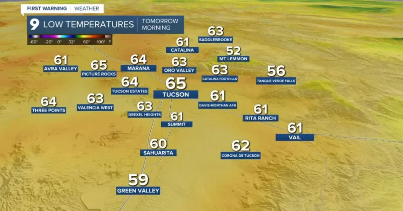
For residents in Pima County and Cochise County, the timing matters. Tucson is forecast to wake up Sunday near 65 degrees, Sierra Vista near 59, and some cooler spots such as Sasabe and Green Valley are expected to dip into the 50s before temperatures surge back into the 90s by afternoon. Tucson should reach about 96 degrees, while Sierra Vista is expected to top out near 86.

The brief rain chance is not expected to spread evenly across the region. It is focused mostly east and southeast of Tucson, with lingering precipitation chances possibly hanging on early Tuesday near the New Mexico state line. After that, drier conditions are expected to return by the middle of the week and continue into next weekend.
Winds will add another wrinkle to the forecast. Breezy conditions are expected east of Tucson Monday and Tuesday, then a more widespread stretch of breezy to windy weather is expected across Southeast Arizona Wednesday and Thursday.
For all the brief changes, the broader pattern stays close to seasonal norms. High temperatures across the region are expected to remain within a couple degrees of normal through next week, which means the main story is not a major cool-down or heat spike but a short-lived shift toward a little more moisture, followed by a return to dry weather.
