Storms are expected to move into northwest Missouri and northeast Kansas after 10 PM Sunday, and some of them may be severe as they push toward the Kansas City area. Sunday night will stay warm, with a low of 64° and a south wind at 25 mph.
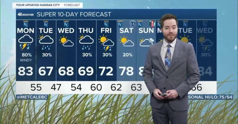
The storms will weaken as they spread into the rest of Missouri, but rain and thunder may still linger after sunrise Monday. Another round will march in after dark Monday, and that one carries the broader threat. Monday evening and Monday night could bring all severe weather hazards, with a high near 83° and a south wind of 15 to 25 mph.

For Kansas City, the forecast points to a wet and unsettled stretch rather than a single passing line. The severe-weather concern is not confined to Sunday night. It extends into Monday evening and Monday night, which means the period after work and into the overnight hours is the part to watch most closely.
By early Tuesday morning, just a little rain may be left behind. Then the sun is expected to break through during the afternoon, and Tuesday will feel cooler. The day starts near 55° and tops out around 67°, with a north wind at 15 mph.
The shift from stormy warmth to cooler, brighter weather comes fast. Kansas City gets one more round of unsettled weather first, but the payoff arrives Tuesday afternoon, when the rain gives way and the temperature drops back to more comfortable levels.