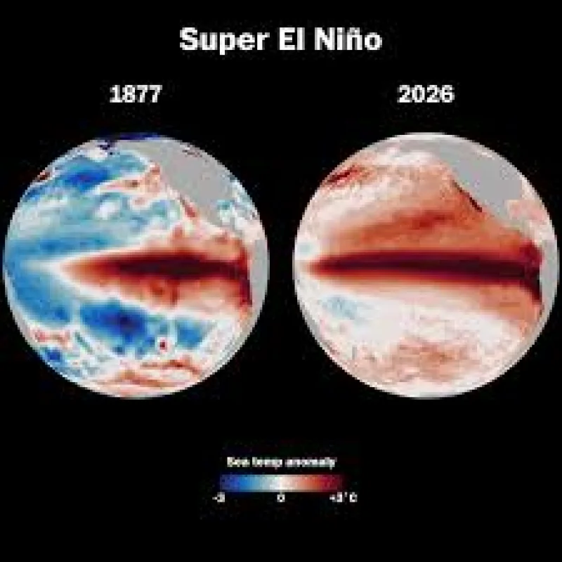
New forecasts are sharpening confidence that the developing El Niño in the tropical Pacific Ocean could become one of the strongest on record. Sea surface temperatures in parts of the Pacific were about 0.5C above normal this week, and forecasters expect the warming to build over the next few months.
NOAA now suggests El Niño will begin within the month, with a two-in-three chance that conditions will be strong or even very strong by this winter. The event could peak in the autumn as a very strong El Niño, or a so-called super El Niño, while later-year forecasts from Australia also show the possibility of an unusually intense outcome.
That pace matters because the region has just moved from La Niña, the cooling phase seen in winter, to a rapid warming trend in a matter of months. Nathanial Johnson described that swing from La Niña in winter to a potentially strong El Niño within a year as a rare occurrence, and said a rise above 2.5C would be a historically strong event. More than half of the latest ECMWF forecast models are already pointing to a temperature increase above 2.5C by autumn.
El Niño is the natural warming of the Pacific Ocean, but the size of this one is what is drawing attention. Forecasts from ECMWF, NOAA and the Bureau of Meteorology are now said to be pretty much aligned in their outcomes, even though spring predictions of El Niño have historically been poor. This year, forecasters have been much more confident than usual, with scientists watching not just the strength of the event but its wider weather impacts and the possibility that 2027 could end up as the warmest year on record.
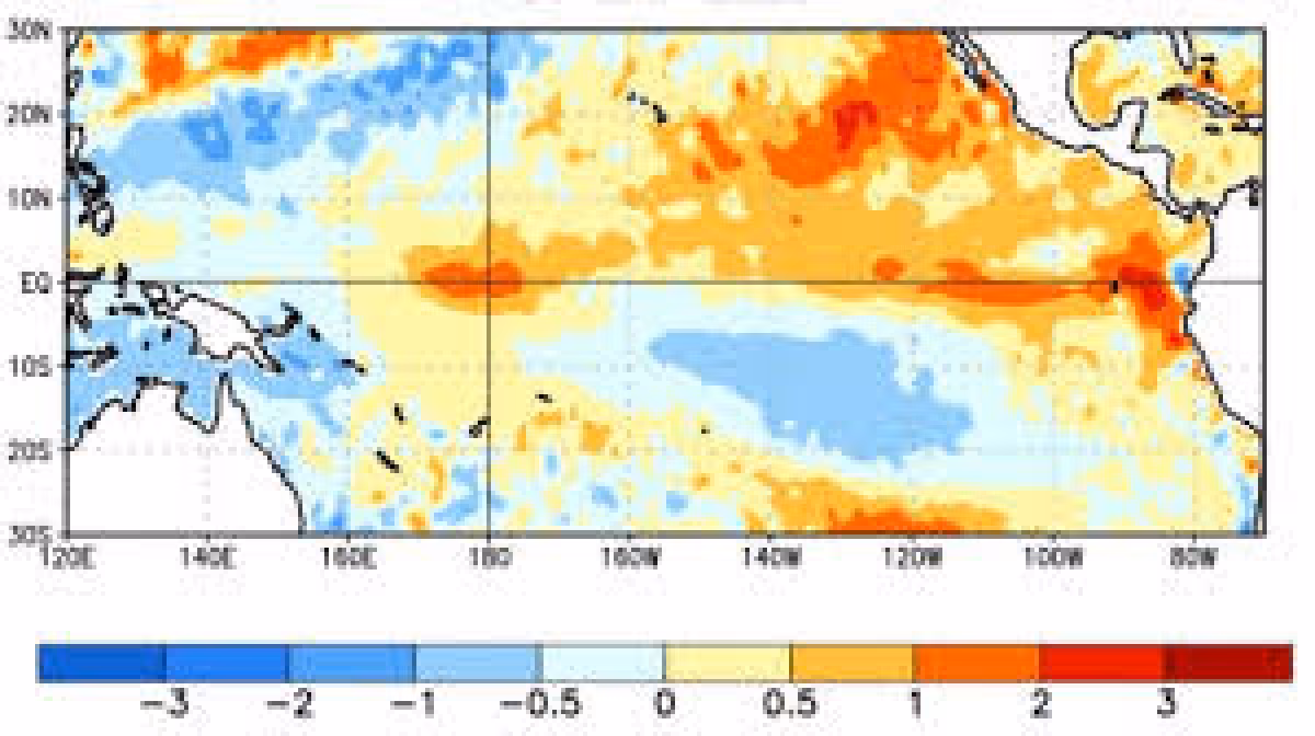
The exact thresholds differ by agency. The Bureau of Meteorology in Australia uses a stricter test, requiring sea surface temperatures in the tropical Pacific to exceed 0.8C above average and looking for signs that trade winds in the western Pacific have reversed. Forecasters also track the Niño3.4 region, using a three-month average against the long-term mean, and a strong or super El Niño is generally marked when that anomaly rises above 1.5C.
The tension now is not whether the Pacific is warming. It is whether the warming reaches the upper end of the forecast range and stays there long enough to remake weather patterns across the globe. NOAA sees strong or very strong conditions by this winter, the ECMWF run shows a large share of models above 2.5C by autumn, and the Australian bureau is already flagging the chance of a very strong El Niño later this year.