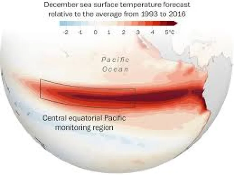
OpenSnow has released its 2026–2027 Winter Forecast Preview, and the Super El Niño Map points to an above-average snowfall season for California and Nevada as a developing El Niño pattern builds. The strongest signals are aimed at the Central Sierra, where forecasters say the statistical odds are highest for well-above-average snow accumulation.
That matters now because the forecast is not just talking about a better-than-normal winter in general. It is calling for the heaviest storm cycles to ramp up after the new year, which gives skiers, mountain towns and anyone watching reservoir and travel conditions a fresh reason to pay attention. Mammoth Mountain and China Peak sit squarely in the bullseye of the strongest signals, while Northern California and the Tahoe region are expected to lean warmer than average, though not nearly as hot as the historic highs seen last season.
Alan Smith said strong El Niños favor an active southern storm track, and that is the logic driving the map. In his view, above-normal precipitation should reach a large part of the US, including the West Coast, Southwest, Southern Plains, Southeast and East Coast. The same pattern is why the forecast also calls for below-normal snowfall along the northern US border and across western Canada.

The Central Sierra stands out because OpenSnow is not merely suggesting a decent winter there; it is identifying that zone as the place with the best statistical chance of well-above-average snow accumulation. That is a stronger call than the broader regional forecast, and it is the detail winter readers are searching for first. In practical terms, the map separates the mountains most likely to cash in from those where the signal is weaker or warmer.
Still, the pattern is not a promise. The last major super El Niño, in 2015–2016, ended near seasonal averages in the Tahoe region and below average in Southern California. That history is the reminder built into this forecast: even strong El Niño winters can send the storm track south without delivering record-breaking snow everywhere the map lights up.
OpenSnow’s own wording leans on that contrast. Smith also said SoCal ski resorts such as Mountain High and Snow Summit tend to see disproportionately higher snowfall in El Niño winters, especially strong ones, than they do in neutral or La Niña years. The forecast does not give a snowfall total for the Central Sierra or for individual resorts, but it does make one thing clear: the first real test of the season is likely to come after the new year, when the storm pattern is expected to build.
For now, the Super El Niño Map is less a guarantee than a warning shot for the winter ahead. If the southern storm track verifies, California’s mountain regions could see a very different season from the one that came before it. If it does not, the 2015–2016 record will be a reminder that even the strongest El Niño can leave some of the West waiting for the snow to arrive.