


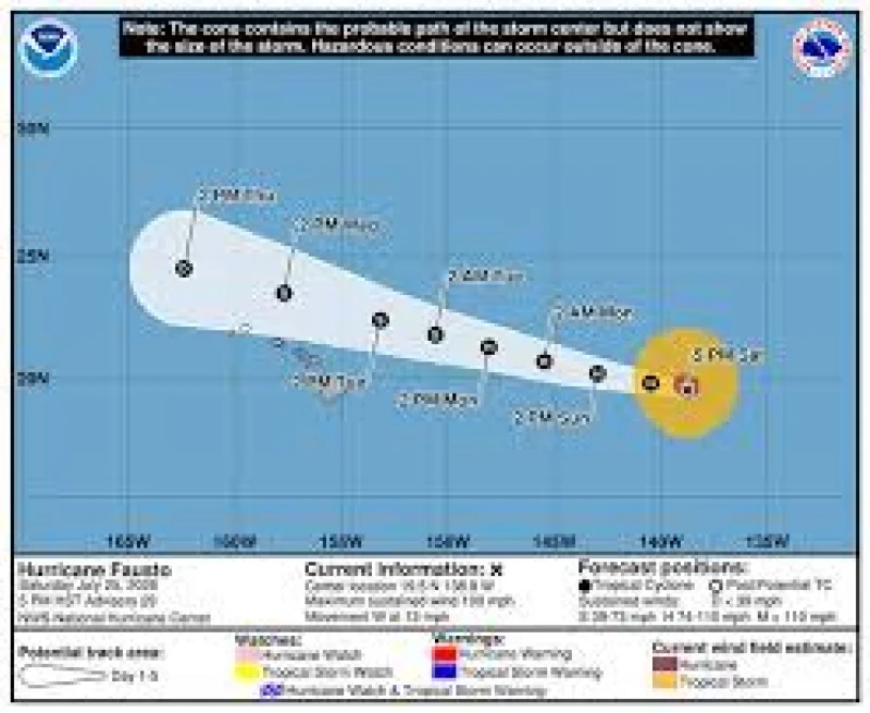
Hurricane Fausto is now expected to pass north of Hawaii on Tuesday and Wednesday as it weakens into a tropical storm, keeping the center offshore even as swells begin reaching the islands first. As of 5 p.m., Fausto was still a Category 2 storm with 100 mph maximum sustained winds, but forecasters said the track had shifted farther north than earlier projections.
That update matters now because the timing is set: Fausto is expected to enter the Central Pacific early Sunday, then continue a slow weakening trend as it turns toward the islands. The storm was about 1,060 miles from Hilo at 5 p.m. and moving west at 13 mph, while hurricane-force winds extended only 50 miles from the center and tropical storm-force winds reached 185 miles.
The latest five-day forecast map left only Kauai and Niihau in the cone of uncertainty, which is narrower than it was before. By Wednesday, Fausto is expected to pass north of Oahu as a weak tropical storm with maximum sustained winds of about 45 mph. That keeps the strongest winds offshore if the track holds, and the risk of sustained tropical-force winds on land should stay low.

Even with the center staying north, the water will feel the storm before the wind does. Swells generated by Fausto are expected to reach Hawaii well in advance of the cyclone, with surf starting to build across east-facing shores of the eastern end of the state on Sunday, then spreading westward Sunday night into Monday and continuing to build through Tuesday. A separate south swell was already producing a high surf advisory for south shores of all islands through 6 a.m. Sunday, with large breaking waves of 7 to 10 feet hitting those beaches.
The part that still needs watching is how close Fausto gets to Kauai and Niihau before it turns away. Forecast confidence is high on dangerous surf and rip currents, and the wind field itself is expected to shrink and become more lopsided as the storm approaches, with the strongest winds shifting to the northern side of the circulation. That means the biggest threat is not a direct landfall but a close pass that could tighten the margin for the islands at the western edge of the cone.
As of 11 a.m., Fausto was still packing 100 mph winds, centered 1,140 miles east of Hilo and moving west at 14 mph, so the next update will be whether the northward track holds or edges a little closer before the storm bends away. For now, the forecast points to a weakening hurricane tropical storm that stays north of the islands, with the ocean hazards arriving first and the core of the storm remaining out at sea.
