


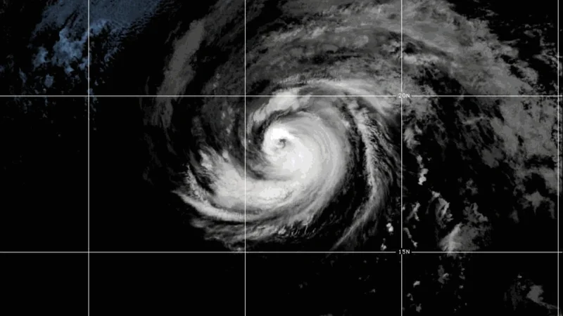
Hurricane Fausto peaked as a Category 2 storm on Friday, but it is now heading toward Hawaii weaker and weaker. The storm is expected to lose strength as it moves over cooler waters and intensely dry air, and by the time it nears the islands it should be only a very weak tropical storm.
Jane Minar laid out the latest Eastern Pacific outlook on FOX Weather, and the timing is what makes Fausto matter today. Hawaii is expected to begin seeing impacts from Tuesday night into Wednesday, which is close enough to put the forecast on the radar for people on the islands right now.
The FOX Forecast Center says the range at landfall remains broad: Fausto could arrive as a tropical storm or fade into a weak remnant low. That uncertainty is why the forecast still carries a warning even as the system weakens. If the storm holds together, Hawaii could still see heavy rain and high surf, especially on east- and northeast-facing beaches.

That combination is the friction point in the forecast. A storm that is being stripped apart as it approaches can still leave a real mark if enough circulation survives to drive rain bands and swell toward shore. The latest guidance does not point to a major wind event, but it does leave room for coastal impacts that can disrupt travel, surf conditions and daily routines across Hawaii.
For now, the best read is that Fausto is not arriving as a strong hurricane, but it is not arriving harmlessly either. The open question is how much structure it keeps by the time it reaches Hawaii, because that will decide whether the islands get mostly rain and surf or a more organized tropical system.
Elsewhere in the Eastern Pacific, Tropical Depression Seven-E strengthened into Tropical Storm Genevieve on Friday and is forecast to intensify quickly over the next few days. The National Hurricane Center expects Genevieve to become the first major hurricane of the 2026 Eastern Pacific hurricane season, but current forecasts keep it over open water and away from Hawaii.
The National Hurricane Center is also watching another system far to the southwest of Hawaii, where development is likely over the next week. A tropical depression may form as that disturbance moves west-northwest into the Western Pacific, adding another item to a busy Pacific forecast map even as Hawaii watches Fausto most closely.
