


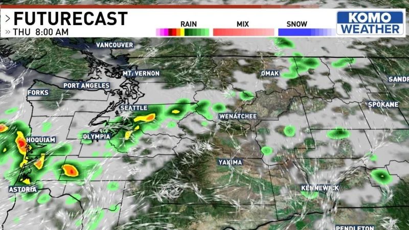
Scattered rain and lightning were moving through western Washington on Thursday, turning the morning commute into the wettest part of the day and raising the risk of slick roads and new wildfire starts. George Waldenberger called it a quick hiccup, but it was one with a Red Flag Warning attached.
Some locations in the Seattle metro area could pick up 0.25 to 0.50 inches of rain, enough to leave roads wet and make accidents more likely. The heaviest rainfall was expected over the Olympic Peninsula, southwest Washington and the Ocean Beaches through the early afternoon, while additional brief showers could pass through Seattle, Bellevue, Tacoma and Kirkland after the lunch hour.

That timing matters because the rain was not expected to spread evenly. Seattle, the Cascade Mountains and Olympia were expected to dry out later in the day, even as more rain lingered over Whidbey Island, the San Juan Islands, Port Angeles and Forks, with Bellingham and Mount Vernon seeing showers through early evening. In other words, the same system was dropping enough moisture to wet some neighborhoods while leaving others on the dry side once the main band broke apart.
The sharpest concern is east of the mountains, where lightning was described as a potential ignition source for future wildfires. A Red Flag Warning was active for the Olympics, the Cascades and eastward through the day, and isolated lightning east of Omak could refire at any point through Friday morning. That is why the forecast is being watched so closely: a short burst of rain can help in one place while a single strike can undo that relief somewhere else.
By nightfall, a canopy of broken clouds was expected to linger, with only a stray shower possible around Stevens Pass or Okanogan County. Then the pattern should ease back toward morning clouds and afternoon sun for a couple of days, before temperatures climb near 90 early next week. For now, Thursday is the unsettled day, and the main question is not whether the weather improves, but where the next strike or shower lands before it does.
