


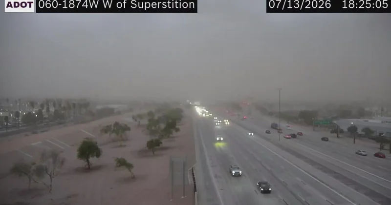
Thunderstorms moved into Arizona on Monday afternoon, and by evening they were already producing severe weather in the Florence and Kearny areas. The same system was expected to keep storm chances alive in the Valley through the night, with strong winds, small hail, heavy rain and lightning all still in play.
That matters because the Valley was not headed into a quiet night. Storms were expected to fade by around 10 PM, but not before some blowing dust or even a dust storm could form, raising the risk for fast-changing visibility problems on top of the usual wind and hail threat. Captain Ashley Losch of the Glendale Fire Department said storms like these can move in and out quickly, bringing strong winds, dust, rain and flash flooding, and can disrupt water, power and gas service.

Monday was near normal across Arizona, but the weather pattern was already turning active in the mountain terrain of Arizona, where storms developed during the afternoon and heavy storms in northern Arizona produced several flash flood warnings expected to expire through the evening. As of 5:30 PM, severe thunderstorms were tracking through Florence and Kearny with 60 mph wind gusts, small hail, heavy rain and lightning.
The friction for the Valley was simple: Tuesday was set to begin under sunny skies in the upper 80s, even as storms were expected to build over the mountains by 2 PM and then track southwest through the afternoon and evening. More flash flooding was likely in the mountains, and strong winds, lightning and blowing dust could travel with the storms. That left the first half of the day looking calm and the second half built for rapid change.
The broader forecast gives Arizona little room to reset. The same pattern was expected each day through the weekend, with the most widespread storm activity likely on Thursday and Friday. Temperatures were expected to ease down by the end of the week, though the Valley was still only forecast to climb into the low 100s by then, with overnight lows in the 80s. In other words, the rain and dust threat is not a one-off; it is part of a weeklong stretch that could keep catching people between bursts of sun and fast-moving storms.
