


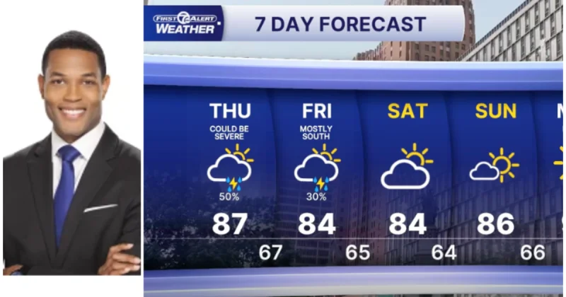
Thunderstorms are set to build across Southeast Michigan on Thursday afternoon and evening, with the sharpest severe-weather risk centered on the Detroit metro area and points south. The most active window runs from 1 p.m. to 7 p.m., when stronger storms could bring damaging winds, large hail and frequent lightning before the atmosphere settles down.
That timing matters because people in Southeast Michigan are looking at the day most likely to disrupt travel, work and late-day plans. Ashlee Baracy, who delivers 4Warn Weather forecasts weekday mornings, at noon and streaming on Local4+, has been flagging the same stretch of the day as the main concern, and all of Southeast Michigan remains under a Marginal Risk, level 1 of 5, for severe weather.

The threat is not expected to end neatly when the clock hits evening. Scattered showers and non-severe thunderstorms may hang on well into Thursday night, which means the cold front will take its time pushing through. A few lingering showers could still be around Friday morning as the front slides south of the Michigan state line, but skies should gradually clear as drier air moves in.
Friday brings the reset. Highs should reach the mid-80s with lower humidity by the afternoon, a noticeable change after a warm and increasingly muggy day ahead of the front. High pressure then settles over the Great Lakes for the weekend, and that should keep the forecast dry with seasonable temperatures across the region.
The catch is that the break may not last long. Forecast models point to another surge of hot weather next week, with the potential for three or more consecutive days of 90-degree temperatures across Southeast Michigan. So while Thursday’s storms may clear the air for a comfortable weekend, the region could be heading right back toward a stretch of heat that feels more like midsummer than a brief pause.
