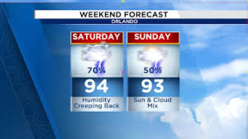
A Severe Thunderstorm Warning was in effect for southern Orlando through 2:15pm as Central Florida faced its best chance for rain and storms today. The warning landed in the middle of a weekend forecast calling for a 70% chance of showers and thunderstorms, with storm coverage expected to build through the afternoon and evening.
That means people in Orlando and across Central Florida were dealing with a day that could turn quickly from hot and bright to loud and wet. Some storms could bring wind gusts of 45 to 55 mph, frequent lightning, heavy downpours and small hail, and localized flooding was possible where storms kept moving over the same places.
The timing mattered because today was expected to carry the greatest coverage of rain and storms, right when many people would normally be trying to use the weekend for outdoor plans. Central Florida was also expected to stay hot and humid, with highs in the lower 90s along the coast and the low to mid-90s inland each afternoon, plus peak heat index values in the triple digits.

Father’s Day was shaping up to be a little quieter, but not dry all day. Rain chances were expected to ease slightly, scattered afternoon and evening storms remained in the forecast, and the first half of the day was expected to offer the best chance to stay dry before storms increased later in the afternoon.
The wrinkle is that the more settled stretch next week does not mean relief from the heat. Rain chances were expected to drop to around 20% next week, and many areas could stay completely dry, especially north of Orlando, while highs hold in the low to mid-90s through much of the week and a Moderate to locally Major HeatRisk remains in place. The quieter pattern was expected to last through at least Tuesday before rain chances gradually increase again in the middle of next week.
Deep tropical moisture remained over Florida, which is why showers and thunderstorms stayed in the picture through the weekend. The broad setup points to another round of afternoon and evening storms, then a brief lull, then more activity returning by the middle of next week.