A tornado briefly touched down in southeastern Putnam County on Tuesday night, and the National Weather Service confirmed it on Wednesday morning after reviewing video evidence of a ground circulation east of Greencastle.
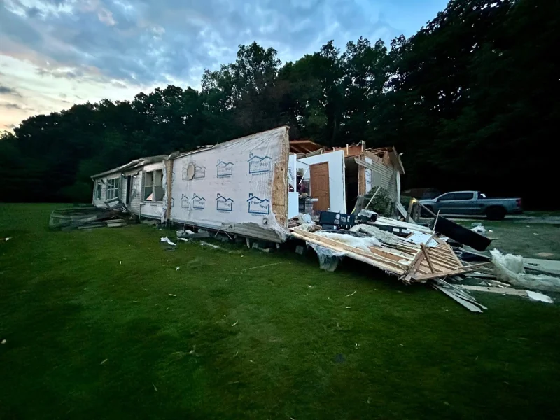
The confirmation gave a name to the damage that the Putnam County Sheriff's Office had already documented in images from the storm: several blown-over trees, debris and structural damage to multiple buildings. No injuries or deaths had been reported.

For residents trying to understand what hit their community, the timing mattered as much as the confirmation. Wednesday's severe weather was expected to arrive in two waves, with the first round moving into northern and central Indiana by mid-afternoon and a second wave due Wednesday night, bringing hail and possible tornadoes. Meteorologist Marcus Bailey said all types of severe weather were possible.
Baugh said the scene left a strong impression. On Facebook, he wrote that watching debris in the air just north of New Providence Church caused considerable concern, and said it was remarkable to watch emergency services get things done. He added that too many organizations were helping to list them all and that most of them were volunteers.
The unresolved piece is how much damage the tornado actually did and how far it traveled. Survey teams were expected to review damage in Putnam and Morgan counties, but no time had been indicated because more severe weather was moving in. For now, the confirmed tornado is enough to show that Tuesday night’s storm was not just another round of bad weather; it was a brief but real touchdown that left enough damage to draw a formal assessment.