The National Weather Service issued a flood watch Sunday for the entire Rio Grande Valley, warning that heavy rain could bring dangerous flooding from Monday afternoon through Wednesday morning. Widespread rainfall of three to six inches is expected, and isolated totals of eight inches or more are possible.
The watch matters because it covers the full Valley at the start of the workweek, when heavy rain is expected Monday and even more rain is likely Monday night into Tuesday. KRGV FIRST WARN 5 Weather said the rain could linger long enough to turn a wet stretch into a flooding problem for people across the region.
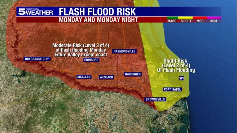
The Weather Prediction Center in Maryland added another layer of concern by placing the entire Valley except the eastern portion of the lower valley under a moderate risk of flash flooding for Monday and Monday night. That level is 3 of 4, and the center said numerous flash floods in that area are likely.
The eastern portion of the lower valley is not off the hook, but it is in a different category: a slight risk, or level 2 of 4. That split shows how uneven the threat is, with the rest of the Valley facing the stronger flash flooding risk while the eastern portion of the lower valley carries a lower one.
The concern stretches over several days, not one passing storm, which is why the watch runs through Wednesday morning. The immediate question for people in the Rio Grande Valley is not whether rain is coming, but how much of it falls in the same places fast enough to overwhelm drainage and push water into streets, low spots and neighborhoods.