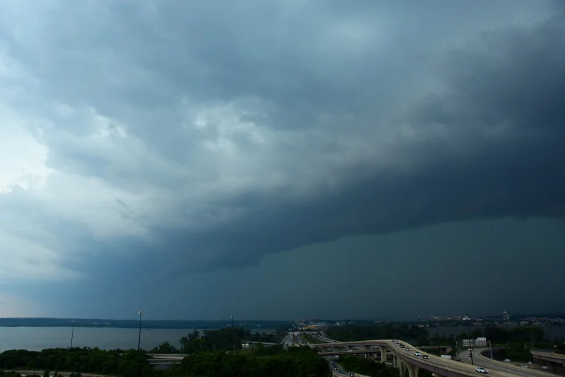
Thunderstorms pushed into the D.C. region Sunday evening under a severe thunderstorm watch that stayed in effect until 11 p.m., with rain already starting to arrive around 6 p.m. The question behind the search — Is It Raining In Washington, D.C.? — turned on the timing of a storm band that was moving east after a hot, sunny day, and by late evening the weather threat had already become immediate for people in the region.
Mike Stinneford said the first band of storms could bring damaging winds, large hail, torrential rain and isolated tornadoes, and that storms were likely to develop quickly once they formed. He said a storm with wind speeds clocked between 40 mph and 50 mph was hovering over Prince William County as of 8:15 p.m. and could move toward D.C. just before 9 p.m., after passing through Southern Maryland by 7:30 p.m.
That sequence matters because Sunday had been dominated by sunshine and temperatures climbing into the lower to mid-90s before the atmosphere flipped. The result was a sharp change from heat to a severe weather threat, with the most dangerous conditions expected to run through at least 10 p.m. and the storms expected to end by midnight.
The unanswered part is not whether the region was under threat — it was — but whether the strongest band would reach Washington, D.C. before the night was over. Cooler, less humid air was expected afterward, and Monday and Tuesday were expected to be sunny.