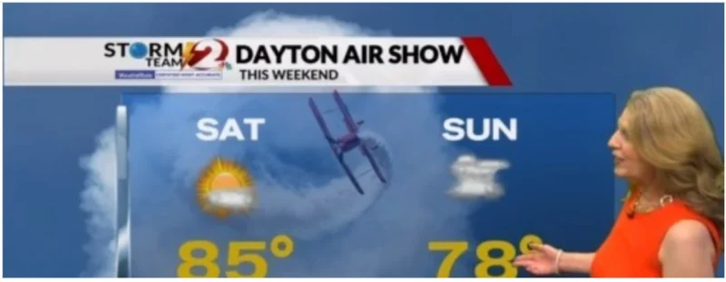
Sunday’s weather for the Dayton Air Show is turning unsettled, with showers, storms and gusty winds expected after a cold front moves through. Today, though, remains on the better side of the weekend forecast, with high pressure delivering warm, pleasant conditions.
That split is why people are checking the forecast now. The best flying weather comes first, then the day tied most closely to outdoor plans changes course. Morning sunshine will give way to a few clouds this afternoon, and low humidity should help the warm temperatures feel more comfortable. After that, clouds increase tonight, and a few showers and storms may develop late tonight as the temperature falls to 68.

Sunday is the day that changes the picture. The high will reach 78, but showers and storms are likely, and gusty winds are expected as the cold front passes. For anyone heading to the Dayton Air Show, that means the weather could shift from manageable to disruptive in a short span of time, especially for any activity exposed to wind, rain or lightning risk.
What the forecast does not give is any response from the event itself. There is no word on schedule changes, delays or safety adjustments tied to Sunday’s setup. Still, the pattern is clear: after Sunday, a cooler and drier air mass returns for a couple of days, then additional showers and storms develop midweek. Highs stay in the 70s on Monday and Tuesday before climbing into the low 80s in the mid to late week.
So the immediate answer for Dayton Air Show-goers is simple. Today looks comfortable, Sunday does not. If plans hinge on the weekend, Sunday is the day most likely to test them.