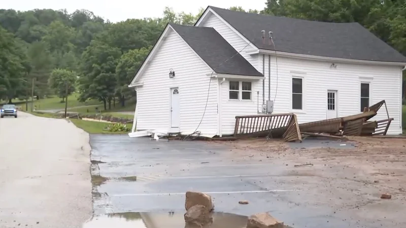
More than 40 million people across the Great Plains and the Midwest were under severe weather alerts Tuesday as life-threatening flash flooding soaked Kentucky and Indiana. In Lanesville, Indiana, 8 inches of rain fell in a matter of hours, and rescue crews with boats were sent into multiple counties after floodwaters trapped residents.
Renea Clark said her car was halfway submerged and described the scene as chaos for the past two hours. Her account matched the scale of the flooding that had flash flood warnings in effect across parts of Kentucky and Indiana, where authorities were warning people to move fast as water rose through roads and neighborhoods.

The flooding was only one part of a wider weather outbreak that stretched from the Plains into the Midwest. A level 3 out of 5 severe-weather threat covered the Dakotas, Nebraska and parts of Kansas into Oklahoma and the Texas Panhandle, where destructive wind gusts, large hail and possibly strong tornadoes were expected. The greatest tornado threat was in North Dakota, while Monday's storms had already ripped through parts of Kansas, including Salina, with wind gusts over 100 mph that damaged homes and buildings, toppled trees and power poles and knocked out electricity.
That left a broad, unsettled corridor of danger from one day to the next. Flash flooding was reported early Tuesday along Kansas I-70, with some stretches getting up to 6 inches of rain overnight, and the wet weather was expected to move into the upper Midwest and Great Lakes on Wednesday and Thursday before severe storms reached the Northeast on Friday.
For people in Kentucky and Indiana, the immediate question was not whether the threat was real; it was how much more water would fall before crews could get to everyone cut off by it. The next round of storms was expected to shift east and north midweek, while heat advisories in dozens of states added another layer of strain for millions more from Minnesota to Mississippi.