Severe storms are expected to sweep across the Midwest on Thursday, putting more than 40 million people from Kansas City to Chicago in the path of damaging winds, very large hail and strong tornadoes. Forecasters are tracking a dangerous setup over a wide area, with wind gusts above 70 mph and hail the size of tennis balls both possible.
Kansas City, Chicago, Minneapolis, Omaha and Wichita are among the cities near or inside the risk zone, and parts of Missouri, Illinois, Indiana, Michigan and Wisconsin are expected to face a level 3 out of 5 severe weather risk. For families watching the weather map, that means the threat is not limited to one corridor or one state line; it stretches across a broad swath of the central U.S. on a day when the hazards can arrive fast and hit hard.

The forecast matters because the same weather system that is driving the Midwest threat is also expected to push east as summer-like heat builds in the Mid-Atlantic and Northeast. That overlap raises concern for people already dealing with high temperatures and humidity, especially older adults, outdoor workers and anyone without reliable cooling or shelter.
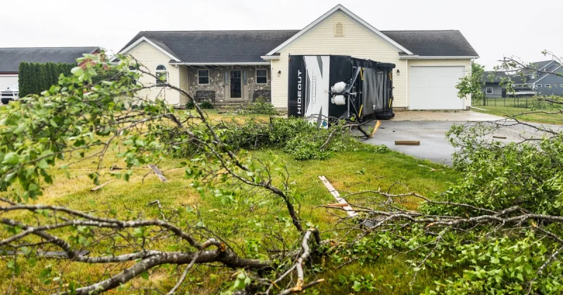
The danger is not theoretical. ABC News reported that an EF-1 tornado in Freeland, Michigan, damaged 40 homes and businesses on Tuesday, June 9, a reminder of how quickly a storm this season can leave a trail of destruction even before the system reaches its next round of targets. Some places could also get hit by multiple rounds of storms, which would increase the risk of flash flooding on top of wind and hail damage.
For now, the clearest takeaway is that Thursday brings a broad severe-weather day with several hazards stacked on top of one another, and the exact local impacts are still unclear. If a tornado warning is issued, the safest place is generally an interior room on the lowest floor, away from windows, while forecasters keep tracking where the strongest storms will form and when they will hit.