


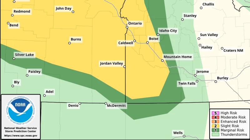
Boise weather turned more volatile Wednesday as a slow-moving upper low stayed parked over the Great Basin, setting up a day of unsettled conditions and a better chance for strong thunderstorms through the afternoon and evening.
Valley highs were expected to climb into the low to mid-80s, roughly 10 to 20 degrees warmer than Tuesday, but the warmer air did not mean calmer weather. The highest risk for stronger storms was forecast across southeast Oregon and west-central Idaho, especially north and west of Boise, where storms could bring wind gusts up to 60 mph, blowing dust that cut visibility, small hail and brief periods of heavy rain. Outside of thunderstorms, breezy southeast winds with gusts between 30 and 40 mph were expected, with the strongest wind farther south of Boise and across southeast Oregon.

The setup pointed to an active weather pattern across southwest Idaho and southeast Oregon, driven by that slow-moving upper low over the Great Basin. Similar storm chances were expected to continue Thursday, and by Friday shower and thunderstorm coverage was expected to increase, with localized heavy rain possible.
The stretch of weather leaves Boise and surrounding communities in a narrow window between springlike warmth and a greater storm threat, and the next few days will decide whether the region sees scattered afternoon storms or a broader round of rain before temperatures cool heading into the weekend.
