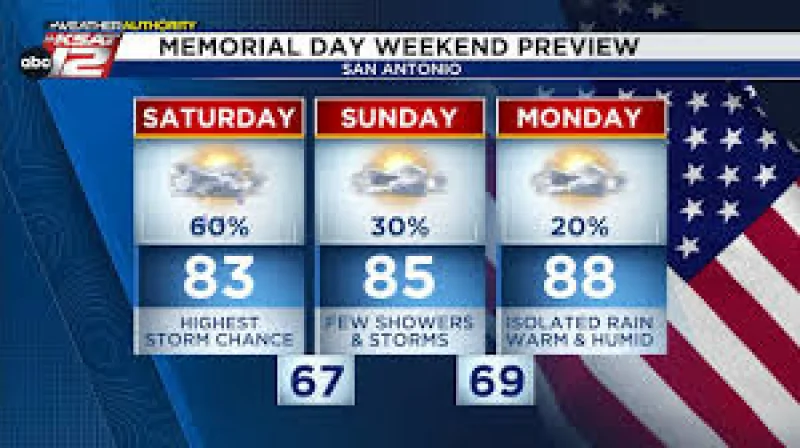
More than 36,000 people were without power early Saturday as a powerful line of thunderstorms swept across southeast Texas, where forecasters said the next round of rain could bring the heaviest downpours along and north of I-10. The flood watch remained in effect until Monday night.
The first big surge of storms was expected between 4 p.m. and 7 p.m. Saturday, with an 80 percent chance of thunderstorms in the forecast. Some areas could get four hours of very heavy rain before only a brief break, and totals of 2-4 inches were being tracked, with isolated spots possibly reaching 5+ inches.
The watch covered most of the viewing area, after being expanded Friday to include Houston and Harris County as well as most of southeast Texas. The far northern and northwestern counties were the only areas left out. That made the scope of the warning broad, even though flooding was not actively happening at the moment.
The National Weather Service said 1-3 inches had already fallen across the area in the last 72 hours, while 6-8 inches had fallen along the coast. The pattern was being driven by an area of low pressure that was expected to move out Monday, but a lingering trough of low pressure could keep scattered showers and thunderstorms in place each afternoon through Friday.
That mix of saturated ground, repeated rain chances and a broad flood watch leaves little room for the region to dry out quickly. The immediate concern is not a single storm, but a stretch of weather that could keep producing heavy rain in the same places before the system finally shifts out Monday.