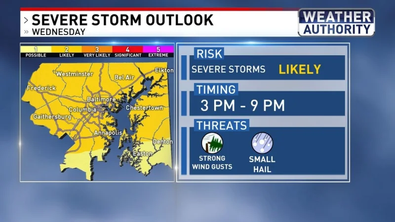
Baltimore weather is set to turn sharply more unsettled Wednesday, with unusually hot conditions expected to continue before scattered strong to severe storms move through from 3 p.m. until 9 p.m. The WJZ First Alert Weather Team has declared Wednesday a First Alert Weather Day, warning that any storm could bring strong gusty winds, downpours and lightning.
The heat could peak before the storms develop, with a record high of 95 degrees potentially tied Wednesday afternoon. That record was set in 1962, and the timing matters because the worst of the storms could overlap with the evening commute and evening activities, when roads and outdoor plans are at their busiest.

Rain then takes over the forecast. Periods of rain are likely Thursday and parts of Friday, and temperatures will stay mainly in the 50s through that stretch. Forecasters say there is potential for at least 1 to 3 inches of rain before the wet weather lets up, a stretch that should bring a much cooler feel to the region after the midweek heat.
The shift carries a second edge for a region that has been dry. The rain is being described as potentially beneficial because severe drought conditions remain in place, and this system offers the greatest chance of drought relief in months. That makes the same weather that could disrupt Wednesday evening plans important for another reason: it may also be the most useful rain Maryland has seen in a while.
Conditions are not expected to dry out quickly after Friday. Rain will become more showery Sunday into Memorial Day, and temperatures may rebound into the upper 60s to lower to middle 70s by the holiday. The pattern leaves Baltimore weather locked in a cooler, wetter cycle through the weekend, with the biggest immediate concerns centered on Wednesday night and the best hope for relief measured in the rain totals that follow.