North Texas is heading into an active weather week, and Dallas-Fort Worth is expected to see showers and thunderstorms on and off through Memorial Day weekend. Monday should be the quietest day in the stretch, but it will still feel muggy and blustery.
Highs near 90 degrees on Monday will feel more like 97, with sustained winds of 20 to 30 mph. That means the day will be hot, humid and windy even before the next round of storms arrives.
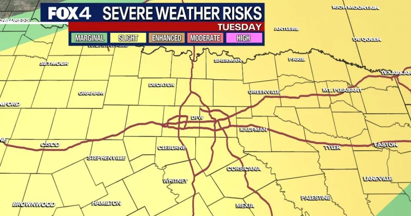
The more serious weather shift is due Tuesday, when a cold front is expected to push widespread rain and storms into North Texas. According to the National Weather Service, thunderstorms are most likely between 1 p.m. and 6 p.m., and a few storms could become strong to severe, bringing damaging winds and large hail. The tornado threat remains very low.
The forecast has been built around a pattern that will not settle down quickly. Multiple weather disturbances are expected to move through the region as the week goes on, keeping the chance for showers and storms in the forecast every day and leaving the area under an unsettled setup through the holiday weekend.
That matters because the rain is not being treated as a one-day event. Decent rain chances are expected to persist through Sunday across DFW, which could affect travel plans, outdoor gatherings and any hopes for a quiet stretch of weather around Memorial Day weekend.
The latest outlook from the FOX 4 Weather Team and the National Weather Service points to a week where the calmest period comes first, not last. After Monday’s brief lull, Tuesday looks like the main storm window, and the rest of the holiday week is likely to keep the region checking the sky.