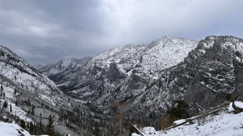
A cold storm is expected to spread snow across the high terrain of the Rockies later this weekend into early next week, setting up what could be the second significant snowstorm of May for some areas. The heaviest snow is expected in the higher elevations of Colorado, Wyoming’s Bighorn and Teton ranges, and parts of the highest ground in the region.
The storm is being watched closely because the snow is expected to be heavy and clingy, the kind that can weigh down tree limbs and power lines and lead to localized outages. In Colorado, the storm should stay more focused on the mountains than the one that moved through May 5-6, and it will also track farther north.
Adam Douty said there are some differences between this storm and the storm from May 5-6. He said this system will focus more on the higher elevations of Colorado and track farther north than the storm earlier this month. He also said that while wet snow may mix with rain showers in Denver from late Sunday night into Monday, no accumulation is expected in the city or at the airport.
That matters because the region has already had a jarring run of late-season snow. Cheyenne, Wyoming, picked up nearly 9 inches during the May 5-6 storm, and another 1-3 inches is forecast there with this system. Laramie and Rawlins could see 3-6 inches, while parts of the Colorado Rockies and Wyoming’s Bighorn and Teton ranges could get 6-12 inches, with locally higher amounts possible on the tallest peaks. Slushy accumulations are also possible across the higher terrain of South Dakota’s Black Hills on Monday.
The storm is not expected to deliver the same punch everywhere. Colorado Springs and Pueblo are expected to remain all rain, and no significant snow is forecast for Salt Lake City. Some slush may accumulate on grassy and unpaved surfaces at higher elevations east of Salt Lake City, including along the benches, but the city itself should avoid a meaningful snow event.
Travel could still turn messy in the right places. Motorists on Interstate 80 in Wyoming may encounter slushy, slippery conditions between Cheyenne and Laramie, and similar issues are possible on Interstate 70 near the Eisenhower-Johnson tunnels. Those spots are where a late spring storm can still cause trouble even when nearby cities stay mostly wet.
The bigger picture is a dry one. Snowfall during the past six months across Colorado and Utah has totaled only 25-50% of the historical average, leaving mountain snowpack well behind normal heading into summer. The North American monsoon could help offset some of the deficit, but it likely will not be enough to end the drought. Moderate to exceptional drought continues across much of the western United States, according to the U.S. Drought Monitor.
That is why another storm in May carries outsized weight even if it does not hit the biggest population centers. It can add moisture to the mountains, but it cannot erase a season that has already fallen far short of the 30-year average in much of the West.