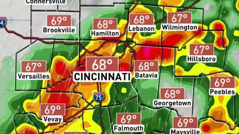
Stronger storms are heading toward the Tri-State on Saturday, with two separate waves possible and damaging winds the main concern. Scattered storms are expected by 9 a.m. and could continue until about 4 p.m., then a greater threat for strong to severe storms is expected later in the day after temperatures climb into the upper 70s.
A Marginal Risk, Level 1 out of 5, is in place, which keeps the severe weather threat on the lower end but not at zero. Winds could gust over 25 mph, and any thunderstorms may bring heavy rain and frequent lightning. Between 6 p.m. and 11 p.m., strong winds and large hail could trigger severe thunderstorm warnings as another round moves through after the warm afternoon.

The timing matters because Saturday could bookend a wet stretch with one set of storms in the morning and another in the evening, just as the region shifts from daytime warmth to a more unstable setup. Another cold front is on the way after the warm stretch, which helps explain why weather Cincinnati is turning active again after a quieter spell.
A few showers may linger early Sunday morning, but the day improves quickly from there. Sunday afternoon looks pretty good, with highs reaching the mid 80s, and Monday should turn even warmer with highs in the upper 80s and feels-like temperatures near 90 degrees. For now, the clearest read is that Saturday carries the best chance for disruptive storms, while the weekend ends on a much calmer and hotter note.