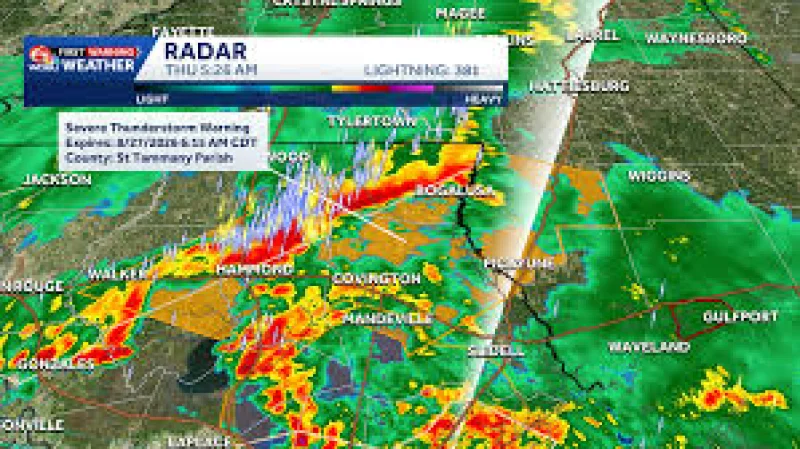
Thursday is now a WDSU First Warning Weather Alert Day for New Orleans and Southeast Louisiana as strong to severe storms are expected to move through the region. Heavy rain could bring flash flooding, and severe thunderstorm warnings are also possible.
That makes the Thursday morning commute in New Orleans the first immediate test of the forecast. People in Southeast Louisiana are being told to expect a wet, stormy day, with the risk centered on the kind of rain that can turn streets slick fast and overwhelm drainage in low spots.

The alert covers Southeast Louisiana and New Orleans, where the concern is not just rain but how quickly it may fall. The forecast points to strong to severe storms throughout Thursday, which means the day could shift from nuisance showers to warning-level weather without much lead time.
What the forecast does not spell out is just as important. It does not give rainfall totals, hour-by-hour timing or storm-track details, so the question for commuters is not how much rain will fall in total but when the heavier bands arrive and whether they line up with the morning drive.
For now, the bottom line is simple: Thursday carries enough risk to put New Orleans weather on alert, with heavy rain, flash flooding and severe thunderstorm warnings all in play at the same time. The hazard that dominates the day will depend on where the strongest storms set up, but the commute is already in the crosshairs.