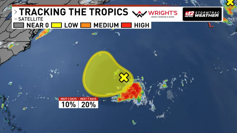
The National Hurricane Center is watching two low-pressure areas in the Atlantic, including one east of Bermuda and another near the northeastern Atlantic that could move toward Portugal and northwestern Spain. Neither system is an immediate tropical threat to the United States, but both have a small chance of turning subtropical or tropical as they drift.
The northern disturbance is the one drawing the closer look because it is developing along a front a few hundred miles north-northeast of the Azores. If it separates from that front Saturday or early Sunday, it could pick up enough structure to gain subtropical or tropical characteristics. It is expected to move east-southeast at 10 to 15 mph toward Portugal and northwestern Spain, where even a non-tropical system could still bring unsettled weather.

That matters now because the National Hurricane Center has kept the chances low, not zero. The northeastern Atlantic low is assigned a 20% chance of development in the next 48 hours and 20% in the next seven days. A front is a boundary between air masses, and when a low stays attached to it, the system is still considered non-tropical. Separation is the key step: without it, the disturbance is more likely to stay part of the larger weather pattern than become a storm of its own.
The second system, several hundred miles east-southeast of Bermuda, is weaker and more constrained. It is producing a concentrated area of showers and thunderstorms southeast of its center, but surface pressures remain relatively high and the system is still poorly organized. It gets only a 10% chance of development in the next 48 hours and 20% in the next seven days, and its window is short because it will drift west-southwest through Sunday before turning northward early next week. In practical terms, that leaves little time for the low to tighten its circulation before the steering pattern changes.
For now, the setup is clear: two Atlantic areas, low odds, and no immediate tropical danger for the United States. The northeastern Atlantic system is the one with the better shot at changing character first, and the real question is whether it can separate from the front before it races toward Europe. If it cannot, it may still reach Portugal and northwestern Spain as a messy, unsettled weather system rather than a named tropical or subtropical cyclone.