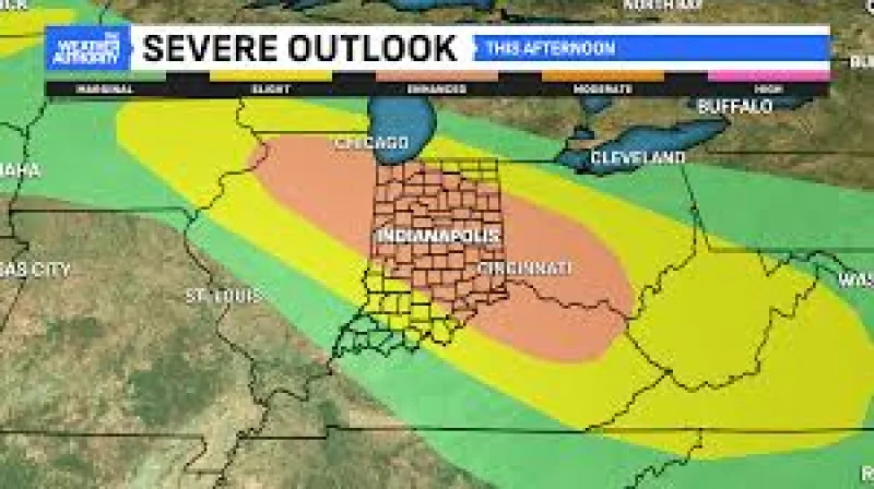
Kentucky is in for several rounds of strong to severe thunderstorms from now through Thursday, with damaging winds and flash flooding the main concerns. A stronger and more organized line of storms is possible late Tuesday afternoon and Tuesday evening, and the highest severe-weather risk is centered north of I-64.
That area is under an Enhanced Risk from the Storm Prediction Center, a Level 3 out of 5 threat for severe weather. A few storms could produce wind gusts greater than 70 mph, and one or two storm complexes may bring pockets of widespread wind damage.

For people in Kentucky, that means the weather problem is not just one round of storms that blows through and leaves. Repeated thunderstorms Tuesday and again Wednesday may dump several inches of rain in a short period of time where storms keep tracking over the same places, and an excessive rainfall risk is already in place. Low-lying areas, poor-drainage locations, creeks and roadways will be especially vulnerable if heavy rain develops.
The main catch is that not every location will see severe weather, even in the areas under the highest risk. Some communities may get only rain or a weaker storm while others see damaging wind or flash flooding, and the difference may come down to where the strongest storm complexes line up Tuesday night and Wednesday. Additional clusters of strong to severe storms are expected Wednesday, and heavy rainfall will stay a concern in places that get hit more than once.
Scattered to numerous thunderstorms remain possible Thursday and Friday, and any stronger storm on those days could still bring damaging wind gusts and locally heavy rainfall. The pattern stays active and potentially dangerous, with heat index values likely to top 90 degrees each afternoon through Thursday and feels-like temperatures above 100 degrees possible across much of Kentucky by the weekend. The next key period is Tuesday evening, when the first more organized round could set the tone for how much wind damage and flooding follows.