


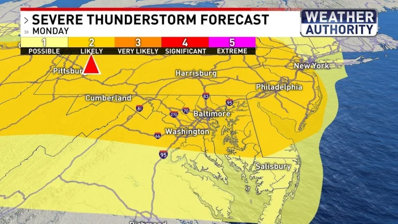
A tornado warning was issued Monday for part of Baltimore City and County as a fast-moving stretch of unsettled weather pushed into Maryland. The warning came on a day when the air was already hot and more humid, with feel-like temperatures near 100 degrees.
The threat did not stop there. A severe thunderstorm watch was in effect for parts of Maryland until 9 p.m., and the same storms could bring damaging winds, small hail, isolated tornadoes and downpours if they develop. That makes Monday a day of active weather, not just a hot one.
The warning matters because it covers a populated part of Maryland at the same time the broader forecast is turning unsettled. Some showers and storms are possible during the late afternoon and evening hours, when the atmosphere can support the strongest storms and the fastest changes in conditions.

That creates the uncomfortable part of the forecast: hot, humid weather is feeding the storms, but the storms themselves can turn severe quickly. The same setup that drives heavy rain can also produce damaging winds, small hail and a brief tornado, which is why the warning and the watch carry more weight than a routine summer storm outlook.
More widespread rain is likely Tuesday, followed by spotty storms Wednesday. By the end of the week and into the weekend, rain chances are expected to decrease and lower humidity levels are set to return, easing the muggy stretch that begins Monday.
The bigger picture is a week that starts with heat and a severe weather threat, then gradually settles down. For now, the immediate concern is the Monday warning over part of Baltimore City and County and whether more storms will form before the day is over.
